« Back to index

2019 NIRA to the PCT

In May 2019, I went on a hike from NIRA campground to the PCT and hiked southbound on the PCT to Agua Dulce. I made videos of my hike. Watch them here.

Ever since my 2009 hike from Santa Barbara to the PCT, I'm sort of obsessed with the Buck Creek Trail, so here are pictures of the portion of the hike where I hiked to Buck Creek and down the creek, as much of it as I took pictures of.

I camped along the trail near Mutau Meadow. It rained that night.

After I packed up, I hiked toward the meadow.

The meadow comes into view

Mutau Meadow in some kind of glowing, beautiful morning light.

Down at the furthest edge of the meadow now. I will have to cross a creek deep enough to have to take off my shoes.

I guess this portion of trail is called the Stonehouse trail.

Here's the creek where I had to take off my shoes. It was cold and I was tired of having wet feet because so far on my trip it had rained several days in a row. My shoes had finally dried over night. The creek was sandy so I was able to walk across without hurting my feet.

I made it to the junction. If you take the Johnston Ridge trail you end up down at the Sespe Hot Springs. It's a very long descent. I took the Little Mutau Trail.

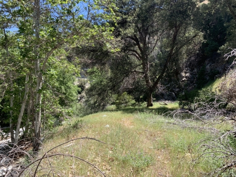
The trail follows a small creek that gets progressively larger as you ascend.

Looking back at the meadow.

People have worked this trail recently.

The creek is getting wider.

Someone built an elaborate fireplace warming station.

There were a few tangled sections of trail that were hard to get through.

An old ice can stove and campsite.

Another fallen tree. This is what most of the Buck Creek Trail looked like. I was so busy on the Buck Creek Trail climbing through stuff like this I hardly took any pictures. This is still Little Mutau Trail.

I stopped here at the last chance for water until Buck Creek Spring, about a day away, and filled up my water.

Somewhere around here I realized I had taken a wrong turn. But there were great views here. There is an abandoned trail here and I followed it for a while before I decided this had to be wrong. I checked my GPS to confirm and backtracked to the right place.

Back on the right trail, I continue up up up.

It's not a bad climb. It's pretty well graded with switchbacks. When I did this trail in 2009 it was faint and hard to follow. There was a motorcycle trail going straight up that was difficult to climb. The real trail was much easier to follow this time around, and much easier to hike.

Evidence that trail work has been done.

At the summit there is a sign marking the wilderness boundary. There is a dirt road nearby. In 2009 I had hiked to that road and camped at an outhouse in the parking lot.

Looking out toward Filmore.

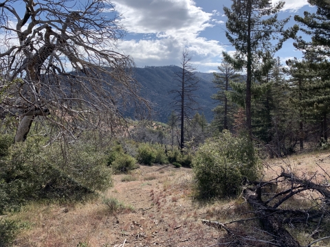
There had been a fire and there were a TON of blowdowns. It was hard to keep on the trail along the top of the hill. There is a road parallel to all this junk I'm trying to get through.

After a while, I could see the road was pretty close and gave up on picking my way through the blowdowns and hiked down to the road instead.

At about 4pm I reached the start of the Buck Creek Trail. In 2009 I had taken a triumphant photo of myself here and then promptly got lost. I never hiked down the Buck Creek Trail. I was determined this time not to miss it.

This might be someone's water cache. I read on various peak bagger sites about people stashing water because to hike all the peaks in this area, there is no water at all anywhere and they're difficult peaks that take all day. So people stash some water.

At first I was really encouraged that it appeared a lot of trail work had been done to all the blowdowns.

This is the summit of Sewart peak. It's really pretty up here with just amazing views.

The blowdowns are starting to close in on me.

So this is where I had gone wrong in 2009. I just kept going down this nice trail and then I couldn't figure out how I was supposed to be on the Buck Creek Trail or how to get back to it or anything. I was very confused. This trail just kept on going and it led me to Snowy Creek. There were campsites and old ruins on the trail. Eventually the trail led me up and over a hill into Hungry Valley. That's when I knew I was lost. I had gone so far I couldn't go back, so I bushwhacked for 4 hours down Snowy Creek. It was hell and at the time I had no idea where I was. I still thought I might be in Buck Creek, but I wasn't.

That's the actual Buck Creek canyon.

Here's the start of the actual Buck Creek Trail.

I was really encouraged that there had been some heavy-duty trail work.

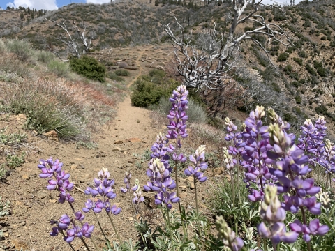
It's a pretty steep and quick descent, but it's pretty and the trail was in great condition.

The trail got a little bit obscure and kept leading me into some kind of tangle, but once I decided to commit to it, I popped out into this little depression. This depression is marked on the topo like a tiny blue circle. It's a sort of dry lake similar to the dry lakes near Highway 33. Not really a lake at all.

I had seen photos of this old junk in various trip reports I researched. I knew for sure I was on the Buck Creek Trail.

More of the old junk I'd seen in other people's trip reports.

The trail was very faint. I followed it as well as I could. Unfortunately, the trail turned into animal trails and I lost it. I was lost once again trying to follow the Buck Creek Trail. I used my GPS app on my phone (Gaia GPS) to see where I was on the earth and I could see that there was a flatter area above me, so I bushwhacked up to it and made camp in a small clearing. Then I proceeded to freak out all night.

I had not seen any water since early in the morning and now that I was lost, I was unsure how long it would be until I could find Buck Creek Spring. I was down to my last half a liter of water. I was worried.

In the morning I was able to easily backtrack to the faint trail and then just walk easily cross-country downhill through the big cone spruce right down to the bottom of the canyon where I found the trail. When I found this metal thing I was really happy. I knew I was going to be okay. The spring had to be close-by.

The trail looked like this a lot.

I found the spring! What a delight. It seemed to bubble right out of the ground. I couldn't actually see if that's what was happening, but it sure seemed that way. I was very happy to see this water.

Not far from the water I found the camp.

The camp even had an old sign on a tree. There didn't appear to be anything printed on the sign.

There were a lot of these old rock walls.

A second campsite near the first one, and near the rock walls.

The trail seemed really good and easy to follow. I didn't get far before it was choked with blowdowns.

Whenever I found good trail, I took pictures. Whenever I was choked by fallen trees, I didn't take pictures because I was too busy crawling and fighting my way through.

More good trail.

More sign of civilization.

I eventually came to another camp. It's at this camp that I took off my pack and my hat. My Zpacks pointy hat. I put my hat in the back of my pack and I guess I didn't secure it well and I lost it.

I fought my way down through more brush and more getting lost and found another camp. This one seemed pretty official.

Looks like an old oven door like the old oven that you can find at Upper Bear camp.

After more fighting through brush, fallen trees, deep and spongy ferns and other traps, I came upon pink tape. Pink tape! Maybe things would improve.

Another camp. I think people fight their way up here and give up and make camp wherever they get fed up.

At long last I found the good trail I could see on Google Earth, where it rises out of the creek. I had hiked this way back on a recon hike I did in 2009 and it had seemed good enough to follow back then. It seemed better now, except for a few large fallen trees that were difficult.

I took a little break for lunch. To handle pushing through all the brush, I had covered my legs with tights and had been wearing my rain jacket and a lycra balaclava so that nothing was exposed to the brush and could get caught. Not my hair, not my skin, not my ears. It was pretty hot and uncomfortable.

The water in Buck Creek is really clear and delicious-looking.

Somewhere around here I went the wrong way again and got lost. This looked like good trail but I think I was supposed to cross the creek to better trail. I ended up fighting my way down buck creek, which was not easy at all. I was frequently hopelessly tangled and my overall impression was this trail was obliterated. Now and then I could make pretty good progress, but in other places I couldn't figure out how to get through. It was as though there had been some kind of massive debris flow down the creek.

When I saw these cliffs I knew I was near the confluence with Piru Creek near the upper end of Pyramid Lake. But oh, the fight to get even to those cliffs took me at least an hour.

And then I found the trail. Good trail!

At the confluence there was a nice camping area.

The camping area was right by Piru Creek, which right here was wide and sandy.

I hiked out along the trail which used to be a road. I followed Piru Creek. I stopped here to wash off and relax a little. It was a pretty hot day.

I made it to Hardluck campground, probably the bleakest, most apocalyptic campground in the entire Los Padres.

Road walking was really killing my feet. The bottoms of my feet were mostly a big giant blister. I really hoped whoever owned this truck would give me a ride. Unfortunately, I did meet the guy and he said he wasn't allowed to give rides. So I would have to walk the 2 miles on the road.

Piru Creek here is pretty big. A nice swimming hole. I had fantasized about going for a swim here, but I didn't.

I'd have to take off my shoes to get across. It was on the other side, drying my feet and putting my shoes back on, that I met the guy with the truck. I told him to let Tony know I was okay and would be there soon. Tony was waiting for me at the locked gate at the trailhead.

I considered taking the shortcut which starts/ends right here. I decided that if the shortcut seemed like good trail I would take it, but if there was the slightest fighting through brush I wouldn't take it. Right away I was tangled in brush so I said no thank you.

Ten years ago I took a photo of myself here with my bicycle. That was my epic adventure hiking the PCT to Canada. How young I was then!

Tony is down there near where those two low hills meet waiting for me.

Yuccas in bloom the last bit before I met Tony. After I met Tony, we camped in our camper at the Los Alamos campground. Then he drove me to Sandberg and I continued my hike southbound on the PCT to Agua Dulce.

You can see the videos I made of the whole trip here. You can see the whole trip on the PCT here as well as some other old albums I made.