« Back to index

Duck to Bishop Pass, August 2010

I had a 60 mile segment yet to do to complete the PCT. The segment ran from Bishop Pass where I exited the trail in tears in 2008 to Duck Pass where I got back on the trail with Tony. I returned to complete this segment in August 2010, hiking southbound because it was the only direction I could get a permit for, which was fine by me. I went by myself.
The Duck Pass trail is very easy. There are nice lakes right away and day hikers/trail runners use the trail. This is a small lake before Duck Pass.
This is another lake below Duck Pass. The pass is ahead.
The pass is ahead. There are trees at the summit.
I'm near the summit now. This is looking back.
I'm looking back at where I've come from.
Duck Pass.
Now I'm on the other side of Duck Pass. There's a small lake called Pika Lake before you get to large Duck Lake.
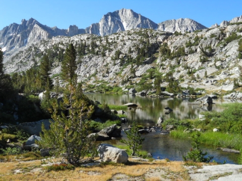
Duck Lake. It has a prominent double-pointed cliff above it.
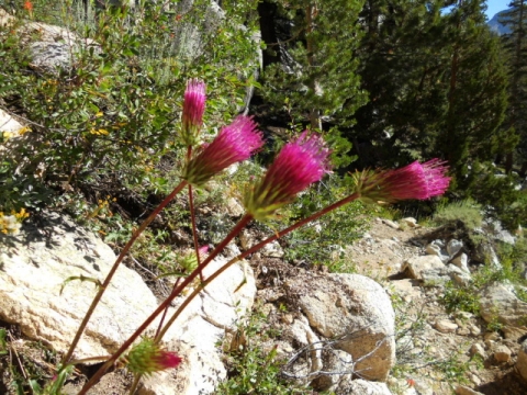
Fuzzy button-like wildflower.
I met a lot of these mule trains during the hike. It seemed like quite a high-impact way to visit the high Sierra. I prefer ultralight backpacking mysef.
I've rejoined the PCT/JMT. I'll be heading southbound.
Duck Lake's outflow forms a long waterfall.
The next lake to visit was Purple Lake. It appears heavily used. There were probably 15 people around its shore. I met a ranger just before it who was checking for bear canisters.
After Purple Lake I climbed a rise through some impressive cliffs and dropped down to Lake Virginia.
This is Lake Virginia.
Lake Virginia was large and the water was inviting. There were some skinny dippers enjoying it.
The rocks in the area were many-hued.
One more look at Lake Virginia.
I press on into the backcountry.
My destination was this meadow called Tully Hole. I had to give a detailled itinerary to the rangers. I did the best I could, but only mosquito-infested places are typically named on maps and I really had no intention of stopping here unless I couldn't go any further.
Switchbacks going down to Tully Hole.
I discovered this tiny yet roaring and voluminus creek hidden in the grass. Here are some nice wild onions growing next to this hidden creek. I would eat the onion leaves from time-to-time as I encountered them.
It was quite a drop to Tully Hole. It was a pretty spot but it did have a lot of mosquitoes, even in Mid-August.
I continued down the creek that flowed from Tully Hole.
I walked through lodgpole forest. It was almost like being in Northern California but drier, not as lush. Nothing does Nor Cal like Nor Cal (or Oregon).
I reached a bridge where there were some people camping. I had to move along.
I climbed from the bridge into forest that reminded me more of how I remembered the Sierras to be. Kind of dry, kind of dramatic. I met a JMT thru-hiker here who had a pack like the one I used to hike to Canada.
This sub-alpine lake/meadow was really nice.
Here it is again.
I continued to climb. I was headed toward Silver Pass.
I could see a granite bench that I was aiming for.
At the top of the bench was a nice lake called Squaw Lake. There was an Indian theme for the lakes in this area.
I camped here at Squaw Lake. I used a mosquito net tent that I sewed myself. I didn't know how to sew a door so I had to lift a corner to climb under. It worked fine. I got a little dewey in the middle of the night but I could watch the stars and alpenglow safe from mosquitoes. Later, the dew dried completely.
The sun setting on the cliffs was nice.
The alpenglow was beautiful.
I got up early to enjoy the sunrise as I hiked. I had to climb the ridge above Squaw Lake.
Above the ridge were more Indian themed lakes. This was Chief Lake. I think it was the quietest place I had ever been. Not even the sound of running water could be heard.
Chief Lake
My shadow. I wore a skirt and sandals. A skirt is just like wearing shorts except when you want to put on long underwear, you don't have to get undressed. I really want a kilt. My sandals were Chaco sandals. My feet were never happier.
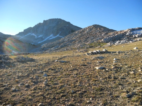
The landscape was becoming more austere.
I am approaching Silver Pass.
There was a snow patch on the trail but I didn't have to walk on it.
From the summit of Silver Pass, the lakes and valleys of the other side beckoned.
It was still a little dark in the valley.
The morning sun was waking up this lake.
It was very meadowy here.
Sometimes it looked like a golf course.
Pretty flowers lined the creeks.
Yellow ones, too.
The trail was rather landscaped sometimes.
There were pretty pink flowers among the rocks and logs.
This was called Pocket Meadow.
Pocket Meadow.
Then I really had to descend. I was going to be visiting some scary creeks that scared me away in 2008.
I was following this slabby waterfall.
Here's a better view of the slabby waterfall.
Here's one of those fuzzy button flowers.
The guide book talked about a potentially fatal creek crossing here. This isn't realy quite a picture of the creek crossing. The crossing was so mild I didn't even realize it was the scary one when I went across. It was supposed to be potentially fatal because you could slip on these rocks, which really were very slippery, and if you fell in the water and if it was fast-moving enough, you could be swept over the edge into the canyon below. I didn't even get my feet wet.
These thistles were nice.
I dropped into a canyon filled with flowers.
I also crossed another creek that was supposed to be dangerous but again, I didn't even notice it enough to take a picture.
I did notice the flowers.
The flowers lined the trail.
I followed the trail down to a junction with the trail to Lake Edison. From Lake Edison I could take a ferry to Vermillion Valley Resort, 5 miles away by foot at the other end of the lake.
So I walked down the 1 mile trail to the ferry landing.
The ferry lands at the head of the lake. Here's the head of the lake.
Trouble was, there would be no ferry until 4:45 and it was only 11:00. So I decided to walk 5 miles to Vermillion Valley Resort instead.
Lake Edison is a reservoir. It's quite large.
The trail took me high above the lake at times. It went up and down instead of level and was very dusty. More like sand. It was very hot out. This turned out to be the most exhausting trail I hiked on for my entire trip.
I struggled in the soft sand with the cool refreshing water below taunting me. There was very little water on the trail and I soon became quite thirsty. So I was very glad when I finally made it to the resort. There would be cold beer here.
Here's the cafe where hikers hang out and eat. I had a burger which was very good. I also had a Deschutes Porter that was great. I really miss Oregon for some reason, as big a torment as the mosquitoes there were. I wish I lived in Oregon in a Tiny House in the forest in Oregon.
Even though I wasn't a thru-hiker anymore, I really wanted to see what I missed, so I enjoyed my visit to VVR even though technically I was not in need of a hamburger at this time. They were very welcoming to hikers.
Here's the hiker box. All the unwanted food (in the barrels) and gear that PCT and JMT hikers no longer wanted.
Hard to believe you are still so close to Mexico all the way up here.
Here's the infamous ferry. It actually ran perfectly.
Here's a picture of me on the ferry.
I returned to the trail and crossed a bridge. There were lots of people camped at this bridge. Little did I know it was because there was a huge climb beyond this bridge.
I have no idea what this was.
I began a series of 53 difficult switchbacks. This man ahead of me and his two friends were some of the very few who ever went faster than me.
The trail reminded me of climbing up from Belden if I hadn't been so lucky to have always descended into Belden. There were flowers on the trail and it was lush and green even if there was only one good location to get a drink of water.
The altitude gained was quick, but there was still a long way to go.
I camped at the top of the switchbacks on Bear Ridge. The trail didn't spend very much time up on Bear Ridge and I didn't want to get stuck not being able to camp anywhere as the trail descended the other side. I needn't have worried though. In the morning I found a few nice camps on the switchbacks down the other side.
In the morning I switchbacked down a flowery slope to Bear Creek. Then I hiked upstream along Bear Creek for many miles.
Rollicking Bear Creek.
Gently flowing Bear Creek.
An easy creek crossing on a tributary of Bear Creek.
The "scary" ford of Bear Creek. This was the second to last of the difficult/scary/dangerous creek crossings I had to do. I was very happy to be here during a time of year when the creeks are not difficult and scary.
More manicured trail. So different from the Los Padres.
I hiked through a meadowy valley on the way to Selden Pass and Lake Marie.
Time to start climbing!
I was really enjoying these high altitude places and wondering why I didn't like them very much in 2008.
Glacial erratics. Boulders left behind by the glaciers after they melted.
I stopped here to have a snack and met some women struggling under HUGE packs.
Beautiful Lake Marie. Or is it Marie Lake.
Selden Pass was above Lake Marie. I'm on my way there now.
Another view of Marie Lake.
Now I'm at Selden Pass. This was too easy! Why did I go home in 2008?
Looking to the south from Selden Pass. The pass has trees. My friends in 2008 were right. There was only one big pass left and the rest were easy ones. Oh well.
The other side beckons again.
There were lots of flowers as I descended. Here are some shooting stars.
This mountain had an interesting geological formation.
Here is aptly-named Heart Lake.
Here is one of the Salley Keyes Lakes.
Here is another. I ate lunch and tried to swim at this one. The water was very cold.
After lunch, I continued on. Flowers lined the trail.
Meadows full of flowers surrounded me.
It was lush and beautiful.
Wild and better designed than any garden.
Next up was a big drop to the San Juaquin river.
Oh boy, it was a lot of elevation drop walking on this exposed, sunny, hot, brushy slope full of switchbacks.
It was impressive, though.
My official itinerary with the forest service had me staying here. This was not a place to camp at all. So I continued on.
I saw this person underneath a very large pack. I had seen so many really big backpacks on this trip. It amazed me. I thought I could sneak up behind this person and take a picture of an example of a really big pack.
Then I started talking to the owner of this really big pack. I had been following bare foot prints for about a mile. It turned out to be her foot prints. She would alternate between bare feet and sandals. Her name was Little Foot.

Little Foot had been hiking the Sierras for over 35 years. It was her life's passion ever since she was a teen. She currently spent 3 months of her life hiking back here or living in her car bumming around the Sierra. She had once been married but her husband didn't

After hiking with Little Foot for about a mile, I continued on ahead of her up the San Juaquin River.
I wanted to hike for another hour and a half. I feared when I got to this cliff-like section I had blown my chance for a campsite.
But I hadn't.
I found a site near the second bridge over the San Juaquin.
I had just enough sun at the end of the day to eat my dinner sitting on these nice rocks soaking my feet in the water. My feet were very dirty.
I set up my tarp over my mosquito net for privacy. I would prefer that testosterone-impaired people not know there's a woman sleeping inside when they pass by on the trail.
In the morning, I headed off to visit Evolution Valley.
There was a final bridge over the San Juaquin to cross.
The way up seemed to follow impossible switchbacks. It only looked that way from this angle.
Soon Evolution Creek came into view. One more "scary" creek crossing to go.
As I climbed a vertical wall, I found a small path leading to a good view of the falls on Evolution Creek.
It was very pretty up here.
Here's the actual creek crossing. I can imagine that during thru-hiker season it's rushing pretty swiftly. It feeds the falls so I can see how a slip could be dangerous. But for me it was very tame. Only knee-high.
There were other difficult crossings of tributaries to Evolution Creek after the crossing.
Here is Evolution Meadow.
A monster in a boulder.
Evolution Creek.
McClure Meadow.
McClure Meadow.
McClure Meadow.
McClure Ranger Station. Someone was inside cooking sausage and talking.
Another difficult creek crossing.
Now I begin the climb to the higher parts of Evolution Valley.
Good views.
My first view of Evolution Lake.
Evolution Lake.
Evolution Lake. Lots of people and stock camped here. Too many in my opinion. People really do not practice very good leave no trace principles, so really popular lakes like this are best avoided in my opinion.
Campers at Evolution Lake.
Llamas at Evolution Lake.
The trail climbs way up high above Evolution Lake after following it for quite a while. It's a large lake.
Crossing the inflow to Evolution Lake.
Now I'm into some high alpine territory.
A jumble of blocks.
A no-name lake where I ate lunch. The sun was very bright up here.
Sapphire Lake. I keep trying to guess which one is Muir Pass. I'm always wrong.
I told the rangers I'd stay ay Sapphire Lake tonight. it's only lunchtime. The place is rocky and the sun is burning me alive. I think I'll keep going. The water is a lovely color though.
Rising above Sapphire Lake now.
If you like the High country, it doesn't get much better than this.
Soft mossy boulder.
I'm starting to guess Muir Pass is around the corner.
Wanda Lake
Wanda Lake was surprisingly alive in this austere moonscape.
Pussy Paws
I skirted the shore. Muir Pass is in sight, straight ahead.
Wanda Lake.
Flowers by Wanda Lake.
Frogs by Wanda Lake. I caused a number of them to leap across the trail into the water.
I think I can see Muir Hut.
Muir Hut is the dark spot in the center of the dip in the ridge.
Say good-bye to Wanda Lake soon.
The tip of Muir Hut is visible. I'm almost there. It was easy to get up here. There were lots of dayhikers who stayed at Evolution Lake. Of course, with my tiny pack, everybody thought I was just a dayhiker, too.
One last look back.
Muir Hut!
I went inside. Here's the fireplace.
Here's the ceiling.
Here's the view out the window. According to the guide book the hut leaks so provides no shelter.
Here I am sitting on the steps. Blinded by the sun.
The view from the hut.
One last look at the hut before I descend. It's 3:30 so I should get going.
I felt ill-at-ease here. I felt like the only thing alive in the universe. It was like being in an old Twilight Zone episode, one of the ones filmed in the desert where the protagonist is sweating and squinting and dying. I think this is Helen Lake.
Helen Lake.
Perfect flowers.
The trail was really difficult here. I was glad I didn't have all the snow and high water of a regular thru-hiker. I didn't think I would be able to handle it. The rocks were difficult, the cliffs would have been scary with snow pushing me off the trail. I would have been in tears.
A snow patch to negotiate. It was a little dicey in my sandals. Snow gets under my toes and they don't have good traction.
Treeline. I'm feeling better already.
It looked like there was a forest fire somewhere. I'm headed for that lake and the canyon beyond.
I was feeling pretty tired from all the downhill. I was hoping to find a place to camp soon.
A confusing creek crossing.
This lake was nice. I was feeling less scared now. I met some nice men who were going to hike on 3 more hours. I expected an hour at most for myself. With their huge packs, it would probably be about the same distance.
I think this is one of those hidden glaciers. It looks like just rocks, but I think there is ice underneath. There's a glacial moraine visible that kind of gives it away.
Ahhh. I breathed a sigh of relief here. I don't know what it is about the big passes that scare me so much. I just do not feel good in those moonscapes. I feel panicked. I just want down from there and back in the living forest.
A nice meadow. I don't think this is Big Pete Meadow yet.
Le Conte Canyon
I camped on this nice bench above Little Pete Meadow. It was warmer here, there was a breeze that blew and kept the mosquitoes away. I could see people lighting campfires in the trees by the meadow despite a campfire ban in the park.
Here's my campsite.
The creek by my campsite.
Little Pete Meadow
It was kind of sagey down here.
In the morning I went to finish my final mile. The trail was ferny.
Here's where I bailed off the trail in 2008. It's my own personal Canada.
Unlike the real Canada, I found the trail register here and signed in.
One last look at the PCT (on the right) and my path out (to the left). I was last here in 2008. I left the trail because I couldn't deal with the scary creeks and the snowy passes. I was alone and had never hiked in snow like that before. I don't know if I am any better able to handle the conditions I experienced then.
Time to hike the 6 miles up to Bishop Pass.
Here is the slabby waterfall I remember from 2008.
It could be a fun waterslide if it wasn't so dangerous.
I'm headed for Dusy Basin.
Flowers lined the steps.
Stormy clouds were beginning to form on the peaks.
I'm in Dusy Basin now. It's a meadowy place with a lake.
I washed my shirt here so I would have something clean to wear when I hitchhiked later. I hung my shirt from my backpack so it would be dry. I continued to wear my long-sleeved shirt. I wasn't naked. I need the long-sleeved one for sun protection and the pockets.
Dusy Basin is one of the prettiest places I've been.
An unusual tree.
Looking down on Dusy Basin. Bishop Pass is almost 12,000 feet. I still have a ways to go.
High sub-alpine meadow. I'm nearing the summit.
Won't be too much longer.
How can ultralight backpacking compare to this? Can you see the full-sized fold-up chairs?
I'm way up now.
The Pass is within sight.
I made it! I took my picture with a Stickpic. I'm not very good at it yet. It was a little chilly up here so I had to wear a jacket.
The summit
The view
A snow patch to walk over.
A cake of flowers.
The way down passes by numerous nice lakes. It is a popular place for beginning backpackers. You can hike to a nice lake in less than 6 miles and do a day hike to the pass.
My hike is complete. I've made it to the trailhead.
I walked another mile down the road to Parcher's Resort where I took a shower for $5. It felt great. I had a clean skirt to wear and the shirt I had washed in the creek. I smelled okay now and could hitch a ride into town. I got to town with a few hours to spare to wait for the bus. It was 100 degrees in Bishop. The bus came around 6:30 and took me to Mammoth. There were some JMT hikers starting their hike also taking the bus. I got them all to agree to share a campsite in Mammoth. I camped the