« Back to index

Ocean View Trail, January 2014

For the three day weekend, TrailHacker and I went up to the Ocean View Trail. We started at the Matillija trailhead. In this drought we were interested in how much water was on the trail. We found a deep pool at one of the creek crossings along the Murrietta Trail. There was no water at Murrietta camp. Later on in this series I took a picture of a spot where the creek had lots of water.
We always stop at the spring on Divide Peak road to fill up our water. This is the deep pool below the spring. The water is all covered in leaves.
We needed to get water for the entire weekend of dry camping. This is my pack before.
This is my pack after. I put 7 liters of water in it. It was significantly heavier.
Here's TrailHacker filling up some cold drinks for the long climb to the top. You can hardly see the water under all those leaves. It's probably tea.
A view of Jameson lake as we climb the Monte Arrido trail. It's not as low as Cachuma, but still pretty low.
Interesting zig-zag patterns in the mountain ridges.
The summit of Monte Arrido trail. Just a little bit further to the road near Divide Peak.
A view of the mountains from the Monte Arrido summit.
Some nice big cone spruces up here.
Now we're taking a little rest up at the road. There are interesting boulders up here. I sliced my leg pretty well on the loppers on the back of my pack when I took it off. Just a scratch, but I bled pretty prolifically.
Rested up, we continued down the road in an easterly direction.
Here's the ridge we look at most of the time whenever we come up here.
Here's the lake we look at most of the time whenever we come up here. This is Casitas Lake.
We pass some interesting boulders right away on the Ocean View Trail.
Up aways there is a flat spot on a ridge next to the trail where our tent just fits. This is where we usually camp when we come up here.
TrailHacker making his dinner.
A close-up of Shangri-La below. Ojai.
Lake Casitas and the ridges.
A pink moment is happening on the mountains above Jameson Lake.
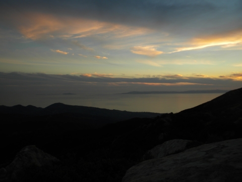
We were treated to a nice sunset. It was a warm evening, too.
A pink moment on the far away ridges around Pine Mountain.
The ocean and Channel Islands again.
The lake again.
It was a long night with a just past full moon. In the morning we set off to see how far the trail has gotten. There's a nice morning sunlight happening on the mountains behind the Divide.
Sunrise on the lake.
Here I am doing one of those Beeman pointing things. I'm not really pointing at anything in particular. This is the spot where there's an old picture of a man on a mule back when this really was a trail. A bunch of intrepid people have been steadily trying to open this trail back up. It's been hit and miss as far as keeping strictly to it, but this spot is for certain the old trail.
The bears have been making use of our handiwork. Now they have a trail to use, too.
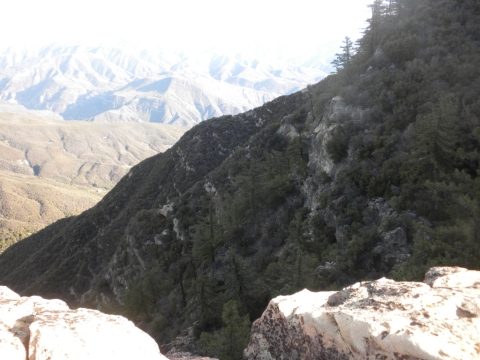
We came out to a steep ledge of rocks. It was quite beautiful here, but also pretty scary.
It's an overhand with a sheer drop!
The trail work sort of pooped out for a spell and we discovered a campsite hidden under a bunch of fallen brush and overgrown bushes. So we cleared it out!
Here's TrailHacker part way through clearing out the camp. He found a coffee pot.
A coffee pot without a bottom.
Also there was a pan with holes in the bottom and a three-sectioned plate and some other odds and ends.
The campsite is all cleared out. Now we have a new place to camp next time we come up here. For sure we won't actually use that ice can fire place. Mostly we were happy about the large flat area for our tent.
There's a canyon that falls away from the campsite. We wondered if during some times of the year if there is water down there. I tried to climb down there but found it rather difficult and slippery.
There's an interesting rock formation right adjacent to the campsite where you can eat your dinner in the sun or take a nap.
There's TrailHacker to give the rock formation a little scale. There were a lot of curious ants in these rocks, however. Probably they were stirred up by all our brushing.
We went out to the trail and did a little cutting to connect the campsite to the rest of the trail work. The trail has gotten quite far now. This is looking down toward Matillija. You can see the Divide Peak road on the left as it goes down to join the Matillija road. The canyon full of trees parallel to the dirt road is where the Murrietta camp is and the canyon going up from Matillija road is Matillija Canyon.
Here's TrailHacker after clearing out the segment from the camp to the trail.
Here's looking down that little ravine below the camp again. We decided to take a little rest here.
TrailHacker's pretty tired. The brush was very dense and dry. Difficult to cut.
We returned to our camp. Here's the sheer cliff again.
Here's a close-up. You can stand on these rocks.
I'm back at the old man on the mule spot looking at all the interesting rock features in the area.
There's a strange flat slide-like section of sandstone below.
There are some unusual spire-like rocks on a ridge in the distance.
These rocks in the background are interesting.
I've zoomed in on them a bit. The full-size picture of this shows TrailHacker as a tiny speck in the upper-right.
Back at our camp, TrailHacker enjoys a pink moment as the sun starts to set.
I finally got some decent sunset pictures up here. Every time we've come there's been a nice sunset. The views are always nice on the Ocean View trail but I think when you spend the night you get the best views because you get the sunrise and sunset and the pink moments.
A pink moment on Santa Cruz island.
A pink moment on the ridges.
The sunset got pretty fiery.
On the way down we stopped at the spring to clean up a little bit. It's hard to see the water, but it was flowing well.
We could hear the creek burbling on the Murrietta trail so we stopped to take a look. There was nice flow here. This is well below the Murrietta Camp which was dry.