PCT Campo to Cabazon, April 2016

March 26, 2016 I decided to hike the first couple sections of the PCT mostly because I couldn't remember much of it. I had a choice between this or a chunk of the Condor Trail but I chose the PCT because I didn't want to be so lonely and also because I wanted to see the ocotillo in bloom, something I've always wanted to see.
I'm wearing a hiking skirt I sewed myself and cut-off pant legs as gaiters to protect from sunburn and brush. The hiking skirt ended up being my favorite piece of

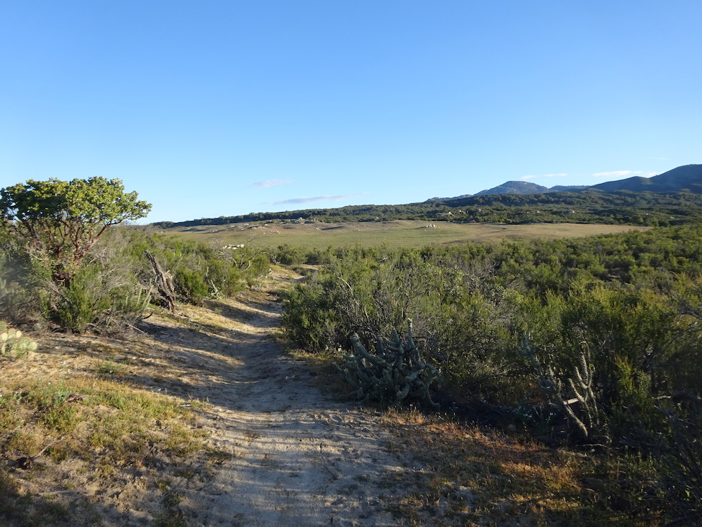
The actual start of the trail is not marked anymore.

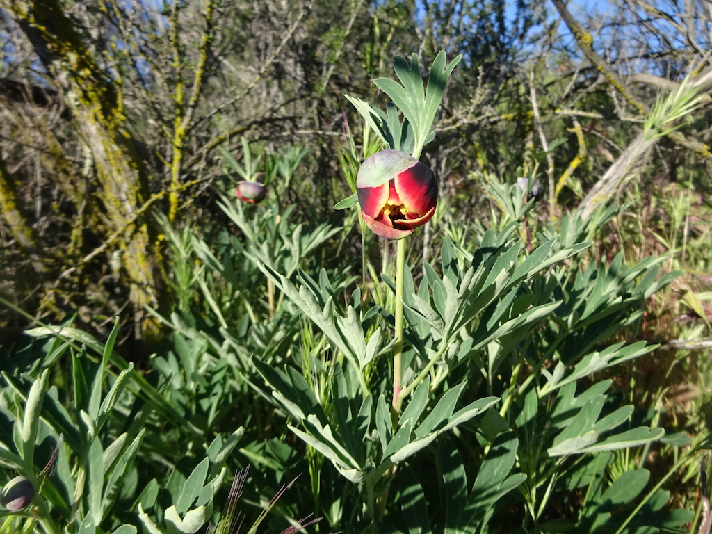
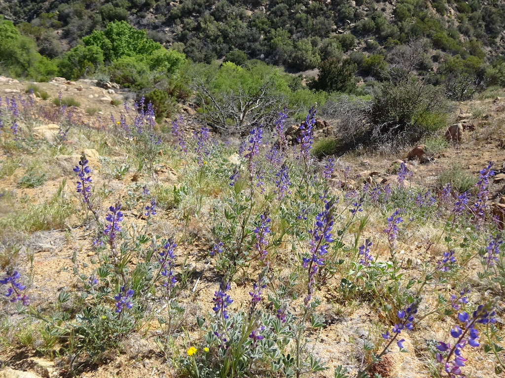
There were not as many flowers as I'd hoped, but there were some. Plus everything was quite green.


I bumped into a guy sleeping here at mile 1. I didn't take his picture though. Apparently the bus that drops you off dropped him off pretty late so he decided to sleep here. I had planned to take the bus, too, but instead I stayed with Scout and Frodo and got a ride to the trail early in the morning from Frodo.


Can you imagine how you'd feel seeing this sign as a southbound hiker?

Cactus almost in bloom.


Footprints became my friends. The hike was lonelier than I expected. I mostly only saw people with huge heavy packs laboring. I'd say hello and then almost never see them again.


The first creek crossing was dry. The trail was much drier than when I did it in May of 2008.


Clematis has much smaller flowers here.


The first of many of these gates you'll see in the early portion of the PCT.


I stopped to have lunch. Cold soaked dried meat, vegetables and potatoes with olive oil

A selfie.

My shoe was giving me a blister. Some extra fabric near the tongue was digging into it.

Another gate.

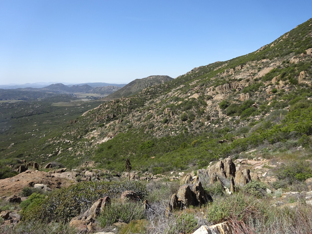
First view of Hauser mountain and the big climb that scares everybody to death. It's really not that bad at all.

I was bummed to see that this sign was defaced. Everybody knows this sign from various blogs and slideshows and now it's ruined.


A side trail to climb to the peak. I didn't take it.


I stopped here under this nice tree to take a rest. It was a hot day and a long climb. A couple day hikers came by while I rested here.

Finally I'm done climbing and it's mostly flat or downhill into Lake Morena.

I like these trees but I can't remember their name. It looks like a cross between manzanita and chamise.

Lake Morena is really low.

The PCT follows the edge of Lake Morena campgroud.

The campground was packed. It was the day before Easter. There was no way I'd stay here. I'd never get any sleep. I've been here before when the campground was full like this and everybody plays their truck radios and kids are screaming all night long.
The famous Rebo was here and a bunch of tired hikers. Rebo tried to convince me to stay, that I'd found "my people". I really would rather sleep, thanks. Rebo sort of

I stopped at the campsite to drink some water and try to cook some dinner. Instead of cooking, I melted my stove and blew up the canister. I had to throw it all away and eat cold food the rest of the trip.


I walked another mile and found a little nook in the scrub big enough for my tent. It was a warm night. My first night on the PCT. When I woke up in the morning it was Easter and I could hear some terrible singing from a church congregation somewhere.

March 27, 2016
About 7AM I continued onward.


The Cottonwood Creek bridge. I thought I saw Frodo driving away, having left another batch of hikers at the monument.


Under the bridge now. The creek was dry.

These three plants were cute.


A nice big oak.

Upstream about 5 miles the creek had a little water. I didn't take any since I knew from the PCT water report that the campground up ahead had faucets turned on. They didn't used to turn them on. I'm glad they do now because it really takes the edge off having to carry so much.

Entering Boulder Oaks.

I got a little water at this faucet at Boulder Oaks campground. There was a woman camped nearby whose name was Melissa. She seemed really nice and athletic. She liked the solitude. I wondered if she was "my people", but I wasn't sure I'd ever see here again.

Under Interstate 8

Interstate 8

The trail was nice here. This was the start of an all day climb into the Lagunas. In fact, I didn't even get to the top by the end of the day.


Interstate 8


This is the PCT I know. Keeps you well away from the water.


Kitchen Creek. There was water here but it was a difficult scramble. I thought there was an easier spot up ahead but I was wrong. When I got to the road above the creek I pondered whether to walk the road to the creek or just push on. Laziness said push on, even though I ended up with less water than I should have carried.


A selfie by this interesting rock.

It was a lot more deserty on this side of the mountain, and pretty hot, too.


Not sure what this is all about.

Cibbett Flat camground. I stayed there in 2008. It's a long drop from the trail. There's a nice creek there and water spigots. I was concerned about my dwindling supplies but thought I could make it easily to Long Canyon. It wouldn't kill me to be a little thirsty.

Right about at this sign there was a lady in a truck waiting for her husband who I had passed on the trail recently. She had tons of water in her truck. I gladly drank a couple pints right there and contined forward, now well hydrated. A little trail magic for me!

Up, up into the hot scrub. At some point I stopped for lunch and met a Dutch guy named Tim. Tim's pack looked HUGE and heavy and he was wearing tight black jeans. He said he was unaccostomed to the climate here. Yeah, it's not like Holland, that's for sure! When I told Tony about meeting Tim he asked if he was the young guy whose mother was frantically worried about. I didn't think so because he didn't look that young to me and he seemed to be having a great time despite his disco pants and

A strange little beetle. I saw a few of these.

I finally arrived at the water at Long Canyon. There was camping available under that tree. I rested here a while and saw Tim arrive and start setting up his tent. I continued on.
It turned out that Tim was the young hiker whose mother was concerned about him. He was doing fine and having a great time.

Supposedly there was a spring in this meadow but I didn't investigate.

At the very far end of the meadow was a road leading into it. I followed the road a bit looking for a nice camp.

I decided the campsite nearest the PCT was the best one. It was another warm night. although I used both of my two sleeping bags. My second night. In 2008 I had had 3 nights before I ever got this far.
I relaxed and played my strumstick for a while, at my dinner, wrote in my journal, went to bed.

March 28, 2016
In the morning there was what looked like fog on the horizon.

The fog was blowing in closer very quickly.

I finally made it into the trees in the Lagunas. It's real nice up here. A little sky island in the desert.


Not only was there less creek and springlet water this time around, various faucets and campgrounds were turned off. This faucet right on the trail was turned off.

This faucet in a campground was turned off.

I went to the Mt. Laguna Visitor Center to get water. I also stopped in at the store for some hot coffee and a few more meals. I didn't pack a full load of food. I bought stuff like spam, cheese and mashed potatoes and one candy bar. The man at the store told me that they were expecting severe weather. High winds with gusts up to 90mph. I didn't believe him since he also runs a hotel. I put my pack cover on in case it would rain and I put my rain skirt and rain jacket on because it was really

I met a few other hikers who were worried about the weather. One was named Betty. She recognized me right away as Piper. I had been trying to hike the trail incognito, using my real name instead of my trail name. Kind of ironic that to be anonymous I needed to use my real name. Anyway, she recognized me somehow so I admitted yes, I'm Piper. Betty was waiting for the cafe to open. I did not expect to see Betty again.

I returned to the trail at Desert View picnic area.

Had to pass a couple intrepid boy scouts, not deterred by the wind and rain.

Already so soon the mountains were changing from pines to oaks. It was also raining just a little bit.


The ceanothus was thick and heady with fragrance.


About here I got a taste of the high winds. I was not yet afraid. Here is a video.


I found a little nook in the chapparal calm enough to eat my lunch. Mashed potatoes, spam and cheese. Not bad.
I found the pack cover was useful to make me feel like all my things in my pack were secure. I secured the pack cover with little bungies I made.


It was way too windy at Pioneer Mail picnic area to stop here and rest. So I continued on.


After Pioneer Mail you climb into this old road that's now a cliff where apparently hangliders with death wishes take off.

The old road is lined with memorial plaques for all the hangliders who have died. It's pretty creepy, especially when there are gusts of wind strong enough to blow you off the cliff. I hugged the inner side as closely as I could for fear of being blown over.


After you pass all the plaques, you have to cross a bit of paved road to get back on the trail. The paved road ends in a sheer drop-off. When I got to that road I think I experienced these 90mph winds the store proprietor warned me about. I was really scared. I could not walk. I truly felt if the wind got any stronger it would pick me up and throw me over the cliff. I stood with my trekking poles planted and bent over and yelled "NOOOOO!!!!!" I didn't want this mountain to take me, too.

The winds were much calmer whenever I was on this side of the hills. I went over and over in my mind whether or not I felt I could sleep on this side, if it was safe. I worried that the wind could shift in the night and then my tent would blow down and I wouldn't have any shelter. It might rain or snow, and without shelter, what would I do? I walked on for miles arguing with myself whether to freak out or stay sane.

I decided to hike to Sunrise Trailhead where I knew there was an outhouse. I really hoped the outhouse was not locked. My plan was that I could take shelter in the outhouse and be safe. I would try to hitchhike out of there but if I couldn't get a ride, I would sleep in the outhouse.
Very near to the turnoff to the outhouse the trail passed right under Sunrise Highway. I decided to climb up to the road and walk the road to the outhouse. That way I would have more opportunity to seek a

They dropped me off in downtown Julian so I decided to go have hot chocolate while I decided where to stay.

And pie.
My status on Maslow's Hierarchy of Needs was quite high now. Sugar coma!

I got a nice room. I hoped to get on the trail again in the morning. As I lay there trying to sleep I realized my feet were very sore.
March 29, 2016.
When I woke up in the morning it was snowing. Here's a movie. I decided that maybe it wasn't a bad idea to take a day of recovery. I had been hiking at least 20 miles per day. From couch/desk to 20 miles per day was pretty rough and a day of recovery would help. I

March 30, 2016
After my zero day I easily got a ride back up to Sunrise Trailhead. I didn't even go over to the outhouse to check if it had been open or locked. I did not care to know what my fate would have been in the alternate universe.

There was a light dusting of snow at this elevation.


I think these are coyote tracks. There were lots of little animal tracks in the snow.

Ahh, back into the bosom of mama PCT.


Soon I was below the snowline, descending to Chariot Canyon.


I remember saying to myself in 2008 that I was grateful I'd never have to hike in Chariot Canyon ever again. And here I was. It was actually quite pleasant, green and pretty.

There was an empty abandoned water cache down here. This is why many people don't like water caches. They become trash on the trail.
I met Tim, the Dutch guy, down here packing up for the day. He said he found good shelter during the storm. He seemed in good spirits.


After a short climb out of the canyon, I began the descent to Rodriguez Spur where there would be water.


Ahh, finally! Rodriguez Spur. Water is here.

And who eventially gathers here but Melissa, Tim and Clint! I had met Clint at Mt. Laguna. He had majored in Nuclear Engineering at UCSB but due to people being against nuclear power, he never got to work on nuclear power plants like he had wanted to. He is retired now.

I rested a while but started getting cold so off I went, back to the PCT.

Now we decend to cross the desert valley and head into the San Felipe Hills off in the distance.


Here was a new cactus variety in bloom, also bright pink like the beaver tail ones.


I bumped into Betty again on my way down. Turned out she had gotten out of the wind and gone to Julian, too, and stayed with friends. She had been corresponding with Tony on facebook. I never saw Betty again after that.
I also met up with Hopper and passed him by.

Tried to take a selfie at this lookout point but was obscured by a bush.


Finally down on the valley floor. Things seemed burned down here.


Aiming for the San Felipe Hills. I was really looking forward to them because this is where the ocotillo are.


It was already a pretty cactus garden down here.


There were a few water caches down here, too.

There are roads down here. Hikers call this area Scissors Crossing but the locals have no idea what that means.


Another water cache under the bridge. It was a comfortable day so I didn't need all these caches.

The trail resumes.

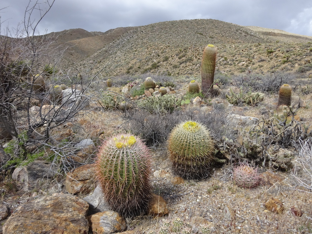
And now for the beautiful blooming cactus garden!


The hill is covered in big barrel cactus.


My first ocotillo! And it's green!

The ocotillo are really blooming! And I am lucky enough to get to see it.


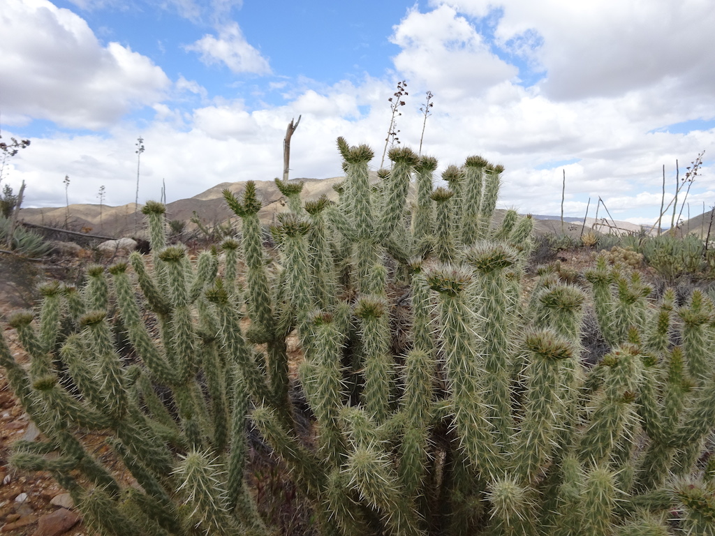
Jumping chollas. Look at how they all jumped off!

About now, seeing all these ocotillo in bloom I'm feeling quite happy.


A close-up of the flowers.


I'm such a nerd. Seeing this beautiful blooming cactus garden actually ranks up there with the Goat Rocks as one of my favorite highlights of the trail. The guide book author is so down on the San Felipe hills, even urging people to write their congress person to put the trail in the Volcan mountains where it belongs. But seeing this cactus garden was one of my favorite days of the trail of all the times I've hiked it.


I could see it raining in the Volcan mountains. Would the Volcans be a rain shadow for the San Felipes or not?


I walked many miles in the San Felipe hills, up and out of the cactus garden. I passed numerous sheltered campsites that I kept wishing I had encountered later in the day. The wind was picking up and it looked like it was going to rain. I hurried along hoping to find a campsite sheltered from the wind. I kept finding exposed sites out on precipices. I was getting nervous. Part of the ultralight tent strategy is good campsite selection and being able to walk far enough to make a good selection

When the rain stopped I went outside and looked for the stake. I couldn't find it. The views were really pretty.


March 31, 2016
The new day was clear and fresh. I found the tent stake when putting away my tent. It had blown way underneath me and I had slept on it all night.


I came upon these heavy boots arranged in the trail like a hiking ghost. I thought about it a bit and decided to pack them out. They were quite heavy, a woman's size 7 and about 4lbs total.
I find it outrageous that after all the trip reports, blogs, forums, facebook pages and gear reviews available out there, there are still people who ignore the advice from accomplished thru-hikers to wear breathable trail running shoes and insist they need big heavy boots. Their punishment for

I camped here in 2008. It wasn't all burned up then.


Ah! The 3rd gate, at long last.

There is a water cache here. These days they put a log book where the cache used to be. I signed the log book.

You must follow a trail downhill for a quarter mile to the actual water cache. There are little tent sites tucked away in the scrub all the way down the hill.

The cache is quite organized. There is a large bin for empty bottles.

There were three pallets chest high with gallon bottles of water. They were labeled with the order in which to use them, the ones you shouldn't use yet covered in tarps to protect from the sun.

 or at a trailer park in Banner, a 4 miles hitch or in Julian, a 12 miles hitch. The 3rd Gate cache saves hikers the trouble.</p><p>Personally I didn't need any water from this cache. I had")
This is the road they drive all that water in on. The local Sierra Club group provides the cache. It's much appreciated. Without it the distance between Rodriguez Spring and Barrel Spring is over 30 miles. You may find water between these two sources in San Felipe Creek (probably contaminated by runoff) or at a trailer park in Banner, a 4 miles hitch or in Julian, a 12 miles hitch. The 3rd Gate cache saves hikers the trouble.
Personally I didn't need any water from this cache. I had

As you near the crest of the San Felipes, you're in chaparral again. It's pretty low and dry.


As you crest the San Felipes you can see what I think is an Indian reservation far in the distance.

It is rumored that Billy Goat slept in this cave. Somehow I doubt it.

It's a very long, tortuous, gentle descent to Barrel Spring.


My toe was really hurting. I hadn't bandaged it very effectively and my shoe had finally ground a big hole in it. I stopped for lunch and bandaged up my toe properly and did some surgery on my shoe to fix it. I never had any trouble after that.

Wow! I've hiked 100 miles. I think this is only my 5th day of hiking. I'm averaging about 20 miles a day.

Suddenly you enter oak woodland. Barrel Spring is near.

And then there it is! Barrel Spring. It's a welcome sight. In 2008 I got here all alone. I was freaked out by all that desert hiking and started crying when I got here. I watched migratory birds take dips and drink from the spring. I saw a Western tanager then.

This time I saw potheads and no birds.

I continued a few more miles toward Warner Springs.


It is a weird place. Beautiful green meadows with cactus.


San Ysidro Creek.


Lots of people were camped here at San Ysidro Creek. I was going to join them but it seemed kind of breezy here. I sought a calmer, more sheltered location.

It's a very small creek. It's also well trampled by cattle.


Finally I found a nice spot beneath a large oak tree next to the creek. This would be my coldest night on the trail. I had two sleeping bags and wore my rain gear and still I was cold. I was all alone here. I was always alone every night on this trip.

April 1, 2016
HopperIn the morning I continued on toward Warner Springs.


I'm nearing the Eagle Rock.


Hmm. There are cattle on the trail. I hoped they would run away.

The cattle did not run away.

They wouldn't get out of the way so I had to walk cross-country around them.

Eagle Rock


More cattle behind Eagle Rock. They started coming toward me, which freaked me out. So I skirted way around them off-trail.


Walking through Canada Larga where there is a small creek.

Finally I'm at Warner Springs.

The resort at the hot springs is now closed. Hikers now gather at the community center. They had coffee, wi-fi, computers, a little store and hiker box. There were water spigots, picnic tables, and places to camp. You could borrow a bucket to hand-wash your clothes and take a cold outdoor shower.
I stopped here to freshen up a bit, buy an Eagle Rock bandana and then go to the post office to get my resupply.

This is the resort that is now closed. Too bad. This was a great place to stay. I picked up my package, walked back to the community center, got some water and hung around a bit. Then it was time to go.

I hit the trail with Hopper.


About here, Hopper said I should lead and show him my pace. I had a reputation now with the few hikers I'd met as being pretty fast. I took the lead and within minutes I never saw Hopper again.

Gonna climb that mountain.


The trail went up this creek canyon. I did not remember this at all. There were numerous creek crossings and plenty of opportunities to get a drink. Lots of little campsites along the way, too.


For a while I wasn't sure I was really on the PCT. The PCT is usually more abusive about water than that. Eventually the trail climbed out of the creek and then I was sure I was on the PCT. I climbed into the chaparral up, up, up.

Warner Valley is far away now.

We're climbing up and over these mountains.


I found a nice little nook to squeeze in my tent. I borrowed this tent from Tony. It's cuben fiber and made by 6 Moons Designs. This campsite was warm and toasty all night. A great spot.


I thought these trees were sort of curious way up there. Turned out I walked right by them when the trail went over to the other side.

April 2, 2016
Morning.


Say good-bye to Warner Springs!
There's a sag pond at the end of Warner Valley, sitting on the Elsinore fault. It had a fog over it.

The turnoff to Lost Valley Spring.

The water from the spring was good.


The manzanita flowers around here are so pink.
While walking back here I felt like this is how the Condor Trail ought to be. It was all the familiar chaparral plants we see in Santa Barbara but with a trail you can actually hike on upright with no cutting tools.


Somewhere in this canyon I came upon P9. I had dinner with P9 in Julian. I guess he had not taken a zero day in Julian like me. P9 was a nice retired man, an engineer, I think. He had been writing his name in the dirt all along the trail. I thought this was strange. Usually you think young kids do stuff like that, but he was a middle-aged man. It's not exactly graffiti or vandalism, but it is sort of annoying. Why would he do it?


I entered an interesting bouldery area.


I'll bet a bird sleeps here at night.


A sign led me to a little side-trail that took me to Mike Herrera's house where there was water available.

I got a couple liters and left a donation.


I didn't go down to his house. I figured nobody was home. Later I talked to some people who said they had a full breakfast there and it was awesome.

When I returned to the trail and reached Chihuahua Vally Road there was a truck there with the biggest PCT stickers I have ever seen.

The trail continued on to a traverse of Bucksnort Mountain.


Suddenly you get an amazing view of San Jacinto way in the distance and the Terwilliger Valley where the town of Anza lies. It's like you can see forever.

Here you can see San Jacinto and behind it, San Gorgonio covered in snow.


The trucks back at the road belonged to a trail crew working the trail. They were making a real difference.

It was a very long descent from Bucksnort Mountain. The day grew hot and the descent went on forever. I stopped for lunch and a little bird sang his heart out nearby.

I aired out my feet and let my shoes and socks dry in the sun while I ate my lunch.

I continued the long descent toward Tule Spring, the next water source.


There was a tiny trickle of a stream. I stopped here and soaked my shirt. A cold, wet shirt felt really good in the heat. It was dry in about 5 minutes.

A short distance from the creek was the turnoff to Tule Spring.


The spring is actually a fire tank with a valve and a hose. There may be water in the creek but it didn't look possible to get to the creek. There used to be a seep and spring near the tank but the water report said it was gone. I didn't look to see if the report was right.

I got a couple liters from the hose. I rested a while and returned up the hill to the trail. While I was resting, a family was also resting nearby. They stopped on their way out to say hello to me briefly. I expected to see them again in an hour, but I did not.


The trail entered another cactus garden.


A lone tree. Not enough shade here to make a difference.

Those mountains must be climbed to get to the Paradise Cafe.

I encountered a guzzler.

Guzzlers are usually installed to help the wildlife have water. I couldn't see how any wildlife could get to the water without drowning.

Nance Canyon was pretty but dry.

Maybe this tamarisk drank all the water.


I was getting pretty tired and it was still quite hot. I figured I would hike up the hill a bit and keep an eye out for campsites. It turned out to be a huge, long, hot, steep and tiring climb. I did not remember this at all from 2008.


More than an hour of climbing later I wondered if it would be safe to camp here. There was a man with a truck here staring at me and yelling something to another truck up the hill. It didn't feel safe and it wasn't very level.

A short while later I found this nice spot to camp. It turned out the man lived on the other side of these bushes in a couple of trailers. He had small children and looked like a nice man, not like the menace I thought he was when he was staring at me from the road earlier.

This was a great campsite. I was very warm here. I got up in the middle of the night to pee and it was a moonless night with so many stars.

My dinner was salmon, cheese, mashed potatoes and olive oil. Very delicious.

April 3, 2016
In the morning I came upon this cache. The water report said this cache was long gone. But it's still here.
I met another family here filling up. I had met them briefly yesterday resting behind a boulder. I never found out their names or their story. They were hiking with what looked like a 14 year old girl.


Shortly after the cache is another cache.

This cache was really cute.


"Books you don't need in a place you can't find."

I think "Pacific Coast Trail" is a joke. Too many people say Coast instead of Crest, but the surfboard makes it funny. I signed the surfboard. I said this is nothing like the real Malibu.


After more climbing, where I tried in vain to catch up to three other hikers way ahead of me, I crested the hill and saw the promised land on the other side. Highway 74, the road that leads to Paradise Cafe.


I hiked to the cafe.

I was in time for breakfast! I had hiked either 8 or 10 miles to get here. I ate with a nice young lady named Bella and her mother and father, the three people I wasn't able to catch up to and the family I had met at Tule Spring yesterday.
Bella is so fast! She started 2 days after me and was already ahead of me. Her parents were equally fast. They did the whole section from Warner Springs to highway 74 in two days. One of their sons has climbed all 7 summits and the mother had climbed

After breakfast I left Bella and her parents behind and returned to the trail. Signs warned of the trail closure ahead.


I had 12 miles to do to get to Cedar Springs Trail, which was Halfmile's detour to avoid the closed area. I hoped to get all the way to the bottom of Cedar Springs Trail. That would make for a more than 20 mile day.


There were small puddles in the rocky area of the trail.

I stopped at the biggest one to get some water. I figured if I got water here I could avoid the long descent to Tunnel Spring.

I treated the water because it had horse lips in it.


The trail was really steep and difficult. The trail would go up very steeply only to drop half the elevation you just gained. Then do it again.
I was able to avoid all the side descents to springs thanks to my horse lip water.


Look at this tree. The wind has definitely shaped it. It was a calm day for me, thank goodness.


I didn't know what this sign meant, but there was a nice campsite here.


Now I can see the desert. I think that is the city of Indio near Palm Springs. There are a lot more cities and communities down there than there used to be.


Finally I've reached the Cedar Springs detour. The switchbacks down Cedar Springs Trail were quite brutal. Very rocky. Ankle-turner sized sharp rocks in the trail.

There appears to be a meadow and a lake down there.


I reached the meadow around 5:30, which was my daily quitting time. It was a luxury to have an early quitting time each night. I didn't want to do too much, you know.


I found a nice spot near the picnic tables. This was my 2nd coldest campsite.

April 4, 2016
In the morning I continued down the trail to Morris Ranch road. Now begins the road walking portion of the detour.

After a mile or so, I reached a dirt road trail to follow.


The dirt road was pleasant enough.


Now to follow another dirt road trail under the power lines. This one was marked as a mountain bike and hiking trail.


After a couple hours of walking, the trail ended and it was time to walk the highway for a couple miles. I tried to play my strumstick and walk at the same time but it was difficult.

I don't know if these pictures show the burn area very well.


I reached the Hemet Lake Market but I didn't need anything.

I went into Hurkey Creek. There's a playground and campground there. I got some water.
Halfmile's instructions said to pass this place and continue on the highway. But the map said otherwise. I skirted the outer edge of the campground and found a couple mountain bikers. I asked them if they knew of a mountain bike trail nearby. There was a gate in the fence that led to it just two campsites away.

And now the mountain bike trail portion of the detour.


The trail continued on, but the detour said to take this dirt road. The road was long and hot. I saw a coyote.

There were panoramic views of the mountains leading up to San Jacinto.


The road was exhausting. I used my umbrella to take the edge off the radioactive sun. I could see I was nearing Idyllwild.


The dirt road emerged onto a paved road on the outskirts of Idyllwild. A nice man offered me a ride but I turned him down. I wanted continuous footsteps.

As I followed this road I noticed one big bend in the road had an empty bottle of vodka every few feet. Some person lives in this beautiful place and still is not happy. Every night they must go drink their sorrows away and

After interminable road walking I reached the State Park campground. I paid my $3. The ranger said I didn't need a permit to hike in San Jacinto. He also informed me there was patchy snow on Fuller Ridge. Okay, so now I knew to pick up my crampons at the post office.

Flat spots were hard to come by. I found a small one. It was a warm spot.
I took a shower. It felt so good. I rinsed my clothes in the shower and set them out to dry on the bushes.

I walked back to town to get my resupply and crampons from the post office.

I also went to have a craft brew at a wine-tasting place. It was so expensive but so refreshing. It was a 12oz IPA. I was pretty drunk after drinking it. I walked across the street to another restaurant and had trout almondine for dinner and another IPA. Now I was quite drunk but my feet felt zero pain anymore.

April 5, 2016
I slept well, but had a headache from the beer in the middle of the night. Took some ibuprofen and felt fine in the morning. I returned to the PCT via the Deer Springs trail. This cut off a bit of the PCT but I still had unbroken footsteps.

Signs warned that I needed a permit just to hike here. There may have been a misunderstanding when the ranger insisted I didn't need a permit. I hoped nobody would stop me, or if they did, they could issue me a permit on the spot. I never saw any rangers so it wasn't a problem.


I reached a junction with Suicide Rock Trail.

That must be Suicide Rock.


My first snow patch.

A really big Cedar tree.


After lots of steep climbing I reached the PCT at Strawberry Junction.


The first snow patch I had to walk on.


Soon the trail became quite snowy.

I put on my crampons. They make it so much easier to walk on the snow. I can continue to walk fast like normal.


If you are ever hiking the PCT and see this rock with the hole in it, turn around. You've gone down the Marion Mountain trail.

Turn around! The Marion Mountain trail has gotten me twice now. Once in snow and once without snow. This rock indicates you've gone the wrong way!

On the Marion Mountain trail, I wasn't yet sure what I had done wrong so I got out my maps to try to figure it out. I thought I would try the apps on my phone.
The apps were useless. The Guthook app was just a red line against a grid. There was no information at all and it didn't give me any indication where I was or even what I was looking at. The Gaia GPS app said it didn't know what Idyllwild was or Hemet. It didn't even know what Yucca Valley was and I had a map in there with Yucca

I waited for the lady a little while but she never appeared. I continued forward on the trail. It had a lot of snow, but a clear path of footprints.

The headwaters of the San Jacinto River, the last water for 20 miles, was nearly invisible under the snow. I filled up 3 liters here and continued on.


I reached the Fuller Ridge Trail.

On the sunny side of the mountain the trail was quite clear.


Mount San Gorgonio looms.

A weird elephant skin rock.

You can see how much snow there is on the north-facing slopes.


I stopped for lunch. I put butter in my cold, reconsituted meat and potatoes. The hiker hunger was starting to hit me and I hoped higher calories and lots of fat and protein would keep it away.
I still hadn't decided what I should do. Should I end my hike in Cabazon? Should I do Terry's crazy Yucca Valley detour? Should I go to Ziggy and the Bear's where I heard there were shuttle buses going to Big Bear? Should I do an out-and-back up to Mission Creek and back? I wasn't sure, so for


I've already descended quite a bit. The peak of San Jacinto is far away.


All afternoon the Fuller Ridge trail was solid snow on the north side. It made for fairly easy going, actually. There were no little hummocks to climb up and down, no searching for the trail tread. I could mostly just follow the footprints and thanks to my crampons, I didn't slip much or get too nervous on some of the steeper sections.

I have left the San Jacinto State Park Wilderness.


At last I'm done with the snow, pretty much anyway.

I took off my crampons here and set off to tackle the long descent of switchbacks off the mountain.

I think they intentionally don't tell you how many miles becaseu it might depress you too much to know.


The trail descends quickly out of the forest. The climate has changed suddenly to something drier.

It's nice here. Warmer and drier. There's a cold wind, however.


I stopped in a fairly sheltered place to call Tony. All along he had been saying he would pick me up wherever I wanted to stop. I suddenly decided that the best thing to do would be to stop in Cabazon. This had been a great adventure, a really wonderful hike. San Jacinto was a fitting end. All that other stuff with the fire closure and various detours just sounded too complicated. It seemed better to save it for another time.
It was only 4pm and I was already so hungry so I stopped for

I started down again. Beautiful San Jacinto loomed above as I walked through a California-style green tunnel.


The climate really changed here in this burn zone. I started keeping an eye out for a good campsite out of the cold wind.


I finally found a great campsite out of the wind. It wasn't quite level enough, or I didn't orient the tent quite right. It was a little difficult sleeping, but it was toasty warm all night.

I had nice views from my campsite.


I could sense from inside my tent that there was a nice sunset. I poked my head out and was not disappointed.


April 6, 2016
I got up as early as I could and started making time to get to the bottom fast so Tony wouldn't have to wait too long. Also, I was really hoping I could wash up at Ziggy and the Bear's before getting in his car.

The hike down the interminable switchbacks was a flower wonderland. It also grew warmer and warmer the more I descended.


Finally I think I can see down to the faucet. I think I see a white car down there. Oh, no! Is that Tony? Will I have to somehow wash up at the faucet?

I zoomed in with my camera hoping it could tell me if that was Tony. It wasn't.


There's a new PCT 200 mile marker. The other side says 2450 for the southbounders.


This rock looks like a cow or a horse.


This rock looks like a bear.

While taking this picture, a rattlesnake raised up and buzzed me. I freaked out and ran away.


At long last the faucet!

I rested here a while and aired out my feet. It was very warm down here!

I started down this road and felt my feet suddenly getting blisters. I learned it was about 95 degrees down here. I don't think it had ever been that hot so far on my trip. Maybe that day hiking out of Nance Canyon it may have been 85 or so.


At the community of Snow Creek, a community that is rumored to not be PCT hiker-friendly, there's this sign with all these PCT landmarks on it. Next to the sign is a house with a PCT sticker and a sherrif's star on the mailbox. I think maybe this is a secret trail angel or perhaps someone who can help you if you are in trouble.

Into the hot, flat desert. The sand is hard to walk in.

Good-bye San Jacinto.

I didn't get a picture, but down in the flats I see a blue shirt coming my way with a familiar gait. It's Tony! He's come to meet me out in the desert on the worst part of the entire trail, bless his heart. He brought me ice water. It was well-recieved. I was surprised how this hot heat was making me thirsty. We hiked together back toward Ziggy and the Bear. I convinced him that if I walked to Ziggy and the Bear's they might be kinder to me and treat me like a regular hiker, let me wash up.<

Hiking under Interstate 10

There's no cooler or place to hang out under here now. I guess people go to Ziggy and the Bear's for that now.

I wandered all over the place trying to find Ziggy and the Bear's house. I probably would have found it had I stayed on the trail, but I was running out of houses and thought I better just wander the streets. This is their view from the front.
I went into the back porch where they let hikers stay. There were two women there. They were the owners of the footprints I had been following for several days, from before Halfmile's detour, through it, along the Fuller Ridge snow and down all
</li><li>Homemade nylon hiking skirt. Has one big pocket on the side. Wished it had a zippered pocket but I ran out of fabric. This was my favorite piece of gear. Went full Scotsman underneath and was never more comfortable. It is knee length to protect from")
The rest of these pictures are pictures of my gear if you are interested.
These are my main clothes.
Top left, going down:
- Bandana
- Fishing shirt (cheaper than hiking shirts but they are basically the same)
- Homemade nylon hiking skirt. Has one big pocket on the side. Wished it had a zippered pocket but I ran out of fabric. This was my favorite piece of gear. Went full Scotsman underneath and was never more comfortable. It is knee length to protect from

My backpack. It's a ULA Relay, which they don't make anymore. The closest comparison is the ULA CDT.
I sewed a scrap of spandex to the back to create a pocket for hats, gloves and jackets so I don't have to dig around in my pack all the time and I don't have to worry things will fall out under the bungee. I also added an extension to one of the side pockets so that I feel more secure about my platypus bottle. I lined it with reflectix but it only kept my water a little bit cooler.

Here's a bunch of random stuff.
- Two white trash compactor bags. I put my sleeping bags in one. The other was a spare which I ended up using to carry out the abandoned boots.
- To the left of the white bags is a pink bag I kept my food in. I work in IT and I guess the bag had a server or router in it at one time. Found it in the trash.
- To the right of the compactor bags is my Zpacks cuben fiber rain jacket. I wore this all the time for warmth.
- Under the rain

More random stuff.
- Two pairs of black tabi socks to wear with my sandals.
- A plastic jar with a screw-top lid. I would soak my meals in here and drink from this like a cup.
- Titanium spoon. A short one that fits in my cookpot, which I sent home due to blowing up my stove. It also fits in the plastic jar.
Food
I went for mailed resupplies instead of shop-as-you-go. The reason for this is that Warner Springs no longer has a store, just a small room
. The stuff sack for the tent was just too tight and I was going to break it if I kept using it, and then Tony would be mad.</li><li>The dark green things: Fleece arm/leg warmers I made by cutting the arms off a fleece sweatshirt. I wore them for")
My two sleeping bags.
- Black: 45 degree Jacks R Better wearable quilt.
- Blue: Golite Ultra 20 quilt.
- The black thing is a stuff sack for my sleeping bag. I used it for the tent (which is the light green thing next to it). The stuff sack for the tent was just too tight and I was going to break it if I kept using it, and then Tony would be mad.
- The dark green things: Fleece arm/leg warmers I made by cutting the arms off a fleece sweatshirt. I wore them for

- The orange thing is my tiny bit of Z-rest sleeping pad. I was barely comfortable.
- The black stick is just something that was there on the garage roof when I was taking these pictures. It's not my gear.
- The gray conical thing is my hat. More on this later.

Here's a better picture of my Jacks R Better quilt. There's a hole in the center you can stick your head through so you can wear it like a poncho. I did not carry a down jacket and used this instead. This is how I used it:
- At night it was like an extra blanket, making my sleeping situtation usually just as warm as at home.
- Before going to bed or after waking, I could wear it like a poncho while doing things in my tent like eating, journal writing, packing up.
- In
 I love my crampons. Maybe I will get a tattoo of them.</li><li>My shoes. Altra Superiors. These shoes are unbearably hot, which is why I brought the sandals and tabi socks. I would alternate.</li><li>Umbrella. Used for sun while walking on that hot dirt road into Idyllwild.</li><li")
Lots of random stuff here:
- Black things: Luna sandals.
- Trekking poles.
- Thing above my shoes: Crampons (with a piece of foam under the spikes to keep from stabbing things while stowed.) I love my crampons. Maybe I will get a tattoo of them.
- My shoes. Altra Superiors. These shoes are unbearably hot, which is why I brought the sandals and tabi socks. I would alternate.
- Umbrella. Used for sun while walking on that hot dirt road into Idyllwild.

- The gray conical thing is my Zpacks pointy hat. This hat was awesome. You clip it to a visor or ball cap. There's a chin strap which I modified to be more secure. I wore it with a visor which allowed the breeze to cool my head under the hat. It could securely withstand fairly high winds. At night I would unzip it and it would lay flat, giving me extra padding under my shoulder and for a pillow.
- My

My strumstick, with a homemade bag I made for it. I used a capo because this thing is really long and I can barely reach the upper notes. The instrument is basically a dulcimer. It has a diatonic fretboard, not chromatic like a guitar. That means Do Re Me Fa So La Ti Do with none of the half tones in between. You tune it 1-5-1. It was my heaviest luxury item. Weighs about a pound. They make two versions that are much smaller. I wish I had the smallest one!
That's all my gear. Some