PCT Lassen to Hat Creek Rim, July 2016

At the beginning of July, Tony and I went up to the Lassen National Park area to hike on the PCT. Tony's plan was to hike to Ashland, Oregon and I was just going to hike for a week with him and then go home. My mom lives up there so we stopped at her house. This is my mom and her husband Lowell, Tony and I.

I didn't get a trailhead picture but Stover Spring is about 3 miles in from where we started on Highway 36 just outside of Chester, California.

The spring was flowing nicely.

It flows into this pond that has a scum of pollen from the trees. This pollen made my eyes feel tired.


A first view of Lassen.


A bridge over the Feather River.


We stopped for lunch under the bridge and put our feet in the water. It was already quite hot.


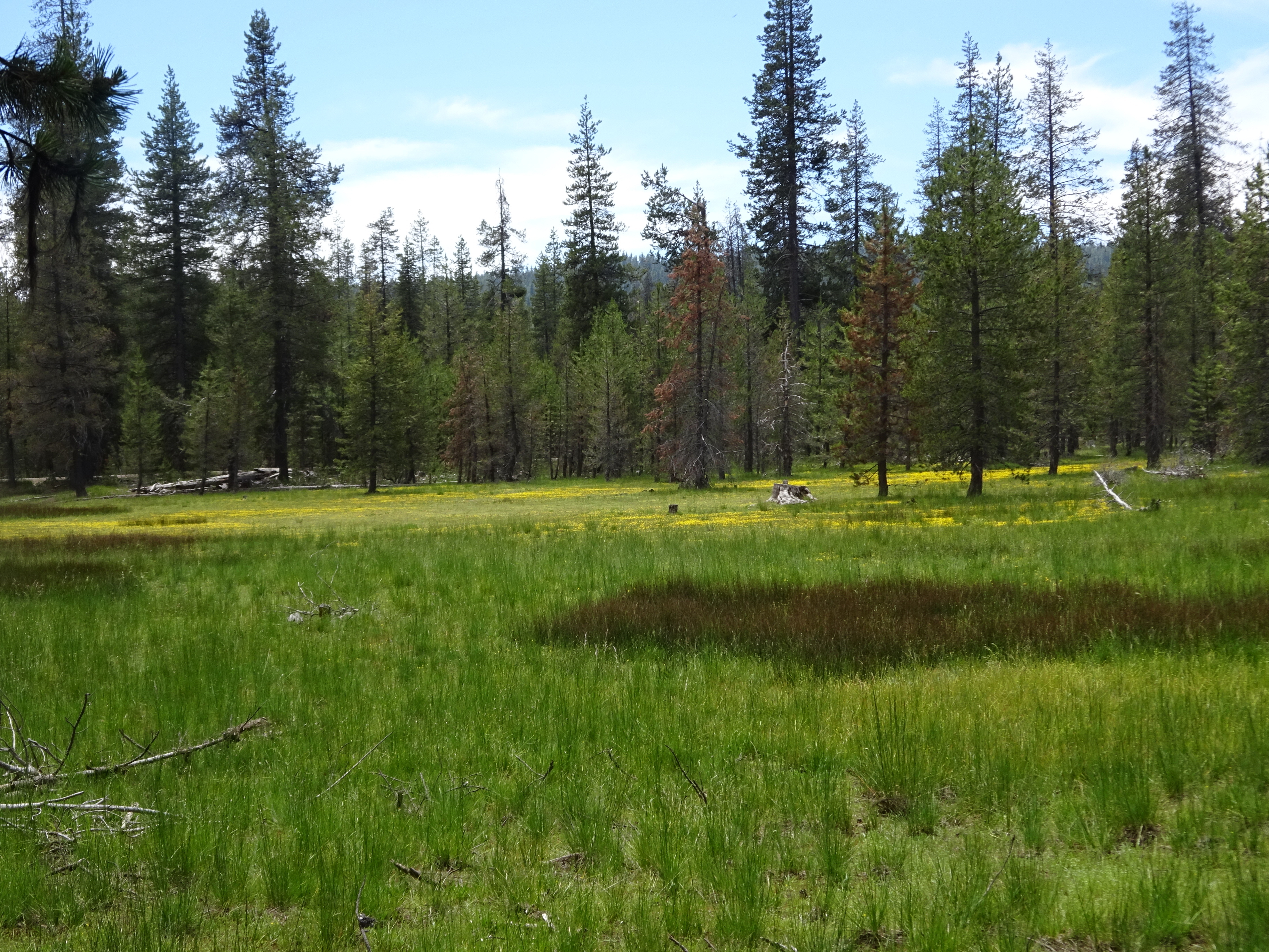
As we neared the park there were some nice meadows.


The ceanothus was in bloom. You could really smell it all around you, even at my mom's house, which is in a little subdivision near the shore of Lake Almanore. It smelled so wonderful.


I think this may have been Little Willow Lake, which is really just a meadow.


There were mule ears in bloom with that mule ears smell.


There was a fork in the trail and it wasn't clear which side we should take. I guess in the past 3 other times I've come this way I took the other fork because this time we came down to Boiling Spring Lake on the left side. This side doesn't have much view and thus isn't very interesting. We didn't stay very long. It was so hot, my feet were burning and Tony was exhausted. We had 2 more miles to Drakesbad.


Finally we have arrived at the meadow by the Drakesbad resort.


Here's the sign on the side of the resort main building. I got a really big beer to drink and it was so refreshing but so big and it got me kinda drunk. We waited forever for dinner. They said they would feed us after all the guests if there was any food left. There was barely any food left and so we got very small plates of food after waiting 3 hours while they served everyone. It was disappointing, especially after all the previous years. Pro tip: If you want to eat at Drakesbad you need a reservation a day in advance.

After dinner we walked to Warner Valley Campground a quarter mile away to camp there for the night.

Warner Valley Campground is a car camp. There were many hikers here. Most of the ones we met were section hikers. We shared our spot with Dizzy and Brownie who were hiking the whole trail. They had reservations for dinner but even they were still hungry.

In the morning we set off on the trail which resumes at the far end of the campground.

The trail climbs up some basalt cliffs and after a steady climb it levels out quite a bit for some very pleasant hiking through thick clouds of mosquitoes.


This area with boardwalks is called Grassy Swale on the topo. There were a LOT of mosquitoes here. It's basically a swamp.


After the Grassy Swale you climb a little bit into an area that looks like pick-up-sticks.


Then you get to the lakes section.


We stopped for a little while at Lower Twin Lake, which I think was the nicest of all the lakes. It was already quite a hot day.

We rested a bit in the shade and then took a trail around the edge of the lake, which was really nice. The lake looked SOOOO inviting, but we didn't go in.


Nobody was home.

We took the PCT alternative that goes by the cluster lakes. Four years ago there had been a big fire and the cluster lakes were all surrounded by burned trees.

We stopped at Feather Lake and took a swim and rested a while. It was very hot and the shallow lake was the perfect temperature.


Tony took my picture in a field of penstemon.


We've now gone all the way around the east side of Lassen and it is time to leave the park and say good-bye.

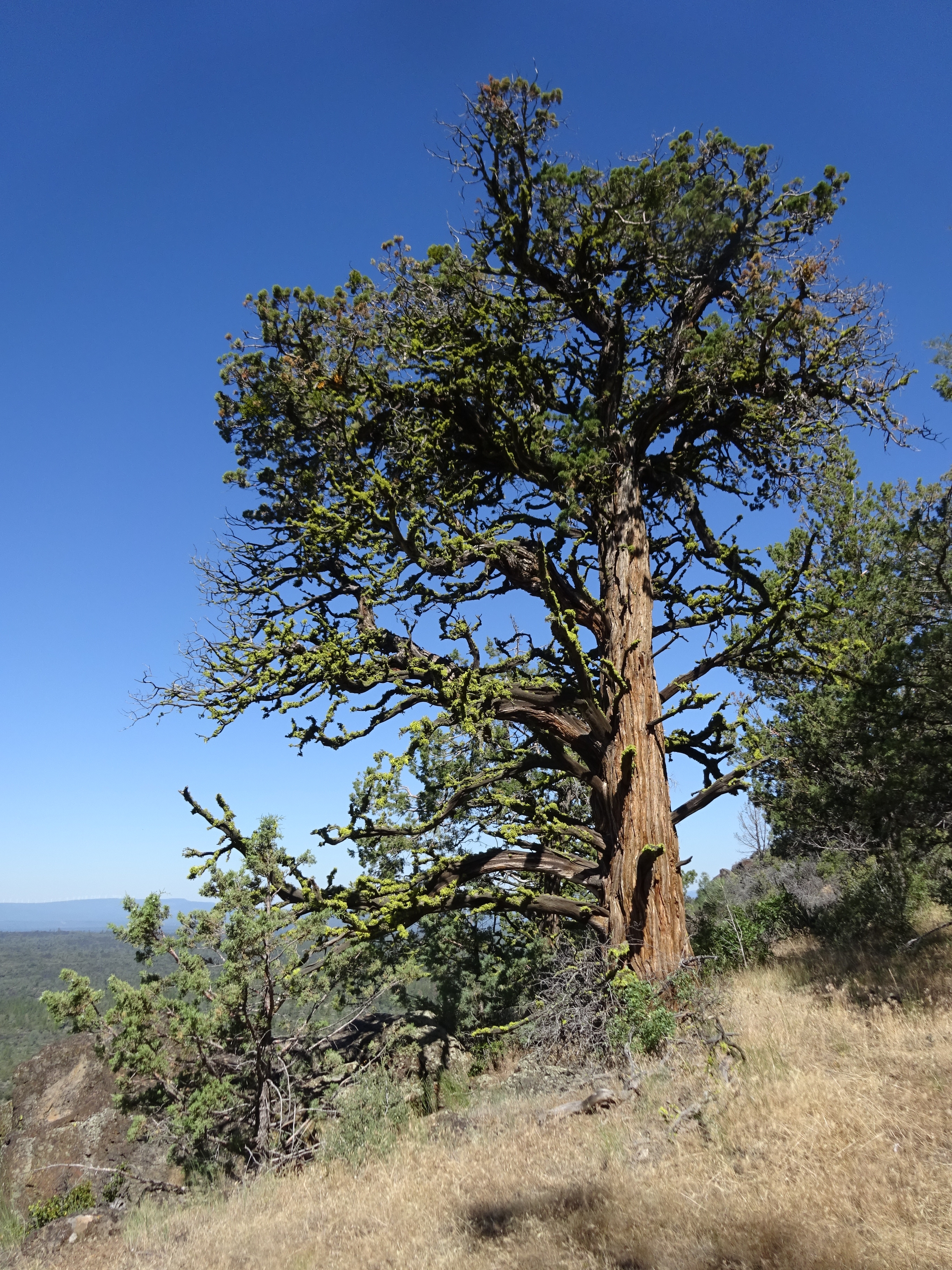
Fungus


We have left the park now and soon will cross over into the Hat Creek area.


Just around the bend here you drop into a tree plantation and parallel Hat Creek coming close enough to take a dip, but not for a few more miles.


Now we've dropped into the plantation, walked through it and are getting near to Hat Creek. The forest was prettier down here than I remembered.


Hat Creek

There's a nice campsite on the PCT right next to Hat Creek. We stayed here for the night. Here is my tent. Tony and I had separate tents because he would be continuing on and I would be going home eventually. I had planned to hike for a whole week but it didn't turn out that way.

The water was cold but not so cold that taking a dip didn't feel wonderful on such a hot day. We were both pretty exhausted. I took a skinny dip even though Dizzy and Brownie were here. They encouraged me and well, I just couldn't pass up the chance to sleep really well all nice and clean.


In the morning we continued on into the pretty forest on flat trail.


Every now and then were these lava escarpments.


Climbing one of the escarpments gave us nice views of Lassen.


Here's the gate on the road that leads to the Old Station Post office. The sign that used to say water, ice cream, trail angel is gone now. There's no longer a trail angel in Old Station.

We went down to the store. They had hot coffee and ice cream. A good hiker's breakfast.

Here's the Post Office next door.

I was hoping to find some mashed potatoes at the store because the mashed potatoes I brought were unflavored and just too bland. I found some in the hiker box. These little theives had chewed a little hole in the potatoes and in a lot of other stuff in the box.


I cleaned up the box a little bit and threw out things they had gotten into. Then I put some chunks of asphalt on top to keep them out. I don't think they were pleased.

Tony had forgotten his platypus hose and like magic I found a brand new one in the hiker box for him. We both got exactly what we needed out of the magic hiker box.

We went back to the trail and into the heat.


After an hour or two we arrived at Subway Cave, a good opportunity to fill up your water before you hike Hat Creek Rim.

Tony resting at Subway Cave. We didn't go into the cave.

The both of us.

Somebody here had a cute puppy.


After a short rest in the shade, it was back to the heat and back to work. Gotta climb up to the Rim.

This is looking toward where we have to climb up. Highway 44 is coming down this hill.

Tony is climbing in front of me. I have a terrible blister on the bottom of my foot that hurts especially with the ground so hot under my feet. My shoes are too thin for this hot lava.


We suddenly get our first view of Shasta!

Lassen is receding.

Good-bye Lassen

Hello Shasta!


There's a vista point for the highway up here. We stopped to rest and have lunch hiker trash style. When you are hiker trash whatever shade you find is like heaven, even here by a pit toilet.

I thought I would try a little donut in my shoe and see if it might help my blister. It did not.

Into the heat of Hat Creek Rim we go. Hat Creek Rim is like the Hurricane Deck of the PCT. Historically it's an almost 30 mile stretch without water and is notoriously hot by the time thru-hikers typically hike it. Sometimes it will be over 100 degrees. I think for us it was around 97 degrees.

Many years ago a fire burned all the trees down. They are coming back and there are pockets where they still exist. It was much prettier up here than I remembered.


About 5 miles from the vista point there is now an access trail down to a reliable creek. It is marked with a post. It's a steep drop of about 400 feet down to the creek. There's no possible way to camp down there. The water is so cold and refreshing. We stopped here around 4pm, rested in the shade for a bit, cooked our dinner and then headed down to the creek to fill up our water while our dinner soaked in the boil-in-bag.

The trail down is way steeper than this picture looks. A couple of spots are difficult and a little frightening.


Down at the creek now. It's choked with brambles and boulders.


We filled up water and washed legs and dunked heads.

Tony really enjoyed the refreshing cold water.

There appeared to be a pool you might be able to swim in a bit, but it was a little difficult to get to.


Back up at the trail this is where we rested and ate our dinners. There was room to camp here but we wanted to continue a little further.

I had the idea to tape some reflectix in my shoes. Reflectix is like bubble wrap sandwiched in thin layers of foil. Wow, finally I could walk without the severe pain and burning of the hot rocks on my blister. I felt great, plus the trail was really pretty here, too.

This is way inland from Lost Valley creek, but the creek is dry up here.


There's an interesting pond up here.


The heat had broken, we were up on Hat Creek Rim where the hiking isn't too terribly difficult, my feet didn't hurt, I guess I got a bit further ahead of Tony than I thought.


All day Tony had been way ahead of me while I struggled in pain with my feet, but now my feet were okay and I figured this is where he'd want to go so I hiked until I got here and waited for him. It was 8pm when he arrived. I think I waited about 20 minutes.

Tony looked thoroughly exhausted and he seemed quite mad at me for hiking so far ahead and just so far, period. We had hiked 21 miles. He had wanted to stop and camp long before. I couldn't remember seeing any place you could camp anywhere.

We slept under the stars here. Nighthawks swooped inches above our faces and sat on the warm concrete in the night and just looked at us. The concrete held the heat for a long time and it was hard to get to sleep being so warm.
In the middle of the night Tony woke me freaked out that his heart was racing and beating irregularly. I did not know what to do about it. The Milky Way was crystal clear and bright. I was stunned by it, but Tony was angered I noticed the Milky Way because he thought he was going to die. The next time something like this happens I'm not going to say anything. I'm just going to dial 911.

In the morning we now had to figure out how to get Tony off the mountain. It was several miles to any kind of road.

Despite Tony's health problems, I couldn't help but notice how pretty it was up here. The 2nd half of Hat Creek Rim takes you quite close to the cliff edges.


We reached Road 22 in a few miles. This is the old Cache 22. The cache is no longer maintained but the lean-to is still here as are a bunch of empty jugs and several chairs. We rested here a bit trying to figure out how to bail out of here.

Tony seemed a little cheerier but he still wanted to bail.


We started down Road 22. Soon we came to a junction with a sign that said it was 17 miles back to Highway 44. Tony had dumped out something like 2 liters of water. I didn't think it was wise to set off on a hot, shadeless dirt road in the middle of nowhere with inadequate water. If we stayed on the PCT it was 9 miles to a paved road. Tony didn't want to stay on the PCT. We had a big fight.

I went back to the PCT by myself. Eventually he followed, mad at me.

After a few miles we came to this little reservoir which is described in the guides as polluted. Tony filled up his water here filtering and adding chemicals. It was already very hot.


Back to the cliffs of Hat Creek Rim.


We stopped briefly to rest in the shade.


We descended off the rim into youthful lava. There was another dirt road quite near as well as paved Cassel Fall River Mills Road in a couple miles.

We called my mom who drove out to look for us. It was pretty hard with our little partial topo maps trying to figure out where we were in the bigger scheme of things, but we were able to find each other.
</p><p>We hiked out a dirt road about a half or 3/4 a mile to Cassel Fall River Mills Road where my mom and Lowell picked us up and took us back to their house. We stopped at J.J.'s Diner for lunch in Old Station near the Subway Cave on the way home.</p>")
(I camped here in 2008, having hiked all the way from Old Station to this tree in a single day. How did I ever do that??)
We hiked out a dirt road about a half or 3/4 a mile to Cassel Fall River Mills Road where my mom and Lowell picked us up and took us back to their house. We stopped at J.J.'s Diner for lunch in Old Station near the Subway Cave on the way home.

We spent the night at my mom's house and the next day decided we would drive out and go see Burney Falls. This is Burney Falls.


It was still so hot but it was probably 25 degrees cooler down at the falls. The water temperature is only 48 degrees and the spray from the giant falls is so refreshing. We stayed here a long time.


There's a short loop trail you can take that goes downstream from the falls, over the creek, upstream and back again so we took that short hike.

Tony thought maybe he could just spend his vacation driving around the trail doing day hikes. I thought that would be fine if he could somehow get me to where I could take a bus to a train station. I was getting nervous about how on earth to get all my crap together and do this. Some of my stuff was at my moms 50 miles away and some of it was in the car.


This loop trail is very close to the PCT.

Tony decided he didn't want to drive all the way back to my mom's house so we found the Burney Mountain Guest Ranch and got a room there. The pool was so refreshing, oh man did it feel good on such an overwhelmingly hot day.


Here's the main lodge by the pool. The resort is a little pricy but it comes with meals and it's really nice. A few years ago we had seen the listing for sale and had what-if dreams briefly. It was cool to see someone had bought it and fixed it up. We even recognized some of the features from what we remembered in the listing. This resort is right on the PCT. The new owner offers hikers the ability to pitch tents and use the pool for $15. There is laundry and a fridge/freezer stuffed full of really good honor-system snacks for really cheap prices. There's a computer with internet, a nice lodge, you can rest in the shade on the porch or whatever you need like that. There were even things for sale like food or tampons or whatever stuff you might be running low on. With the trail angel in Old Station gone and with the resort in the tail end of a very long hot waterless stretch, I imagine a lot of hikers will be grateful.

I know I was grateful.


We got the "Bear room".

Tony just happened to bring all his backpacking gear. He decided he wanted to continue hiking, at least to Burney Falls. So in the morning I drove him back to where we had bailed out and dropped him off. Then I came back to the resort and went back to bed. A few hours later the lady in the resort had made eggs and bacon so I had some breakfast and talked to her for a while. Then Tony called and said he was getting close to the resort so I went out to hike the PCT and see how close the resort actually is to the PCT.


They had put signs on the PCT to lead you to the resort.

Here's the driveway to the resort. I think the red soil reminds me of Africa.

There were osprey nests with birds in them on the big power lines. The mama was circling my head trying to keep me away from the nest.


Here's one of the nests.


Tony kept hiking toward Burney Falls. I drove the car to Burney Falls and parked outside the park so I didn't have to pay to get in. I walked into the park from the PCT.


 and hiked into the park. Here are our tents at the hike-and-bike site.</p>")
I spent the entire day sitting either by the falls where it was cooler and shady or by the store where it was just shady. It was very boring. In the afternoon Tony arrived and fell asleep by the store while I waited some more.
We paid for the hike-and-bike site so we could camp here. I moved the car to a parking spot that didn't have a no parking overnight sign, grabbed what little of my backpacking gear I had brought (I had not expected to spend so many days away from my mom's house. I had expected we'd just go home after Tony's heart problem.) and hiked into the park. Here are our tents at the hike-and-bike site.
 was very exhausted. They were trying to hike slow and eat a lot to get his strength back. We camped at the hike-and-bike with them and talked for a while at the picnic tables.</p>")
Brownie and Dizzy had made it here. They are hiking very slowly because Dizzy (the husband) was very exhausted. They were trying to hike slow and eat a lot to get his strength back. We camped at the hike-and-bike with them and talked for a while at the picnic tables.

In the morning Tony decided to continue his hiking adventure and continued on the trail alone to Ashland. He figured he would take it easy and be okay. Probably without me to make him walk farther than he wants, everything will be fine.
I said good-bye to him in the morning and drove back to my mom's house to get my things and drove straight home to Santa Barbara.