Pine Mtn. Logde Sespe Loop, March 2015

I took a solo 3 day trip over Cesar Chavez weekend. I went out Rose Valley toward Pine Mtn. Lodge, over the other side to the Cedar Creek trail, then along a motorocycle road to Johnston Ridge trail, then down to the Sespe Hot Springs, then back along Sespe Creek trail.
A friend says all my "Diane's Big Adventures" should be called Tony's Big Adventures because I always take pictures of Tony. So I tried to take pictures of myself, but as you can see, the pictures of me are mostly

Sespe Creek was already pretty low. This is the first crossing below Piedra Blanca.

The Piedras Blacas were beautiful as always. I got started at about 8:45 so I got to enjoy a pleasant morning.

This rock sort of looks like it has a face in it.

Steps in the stone.

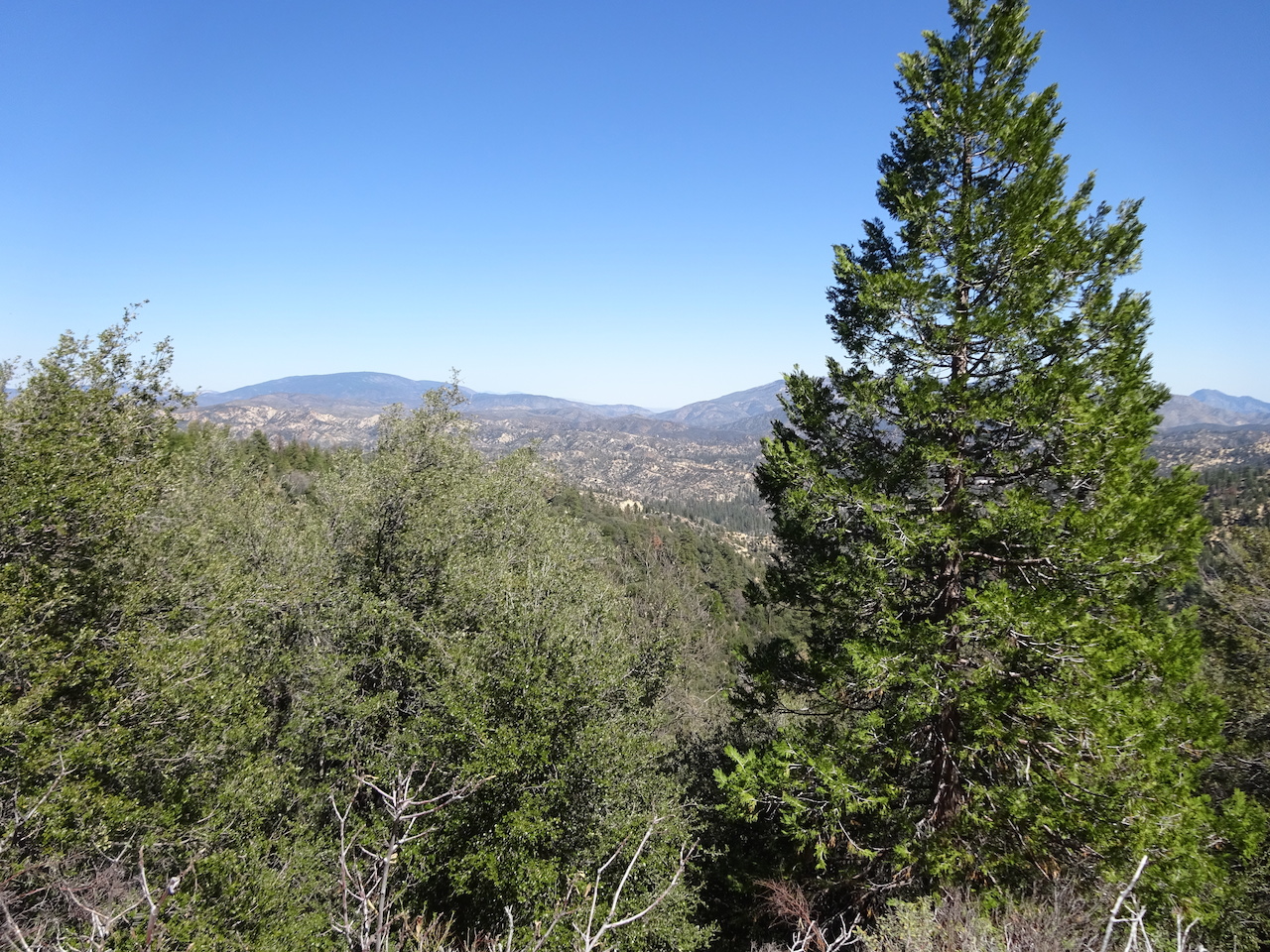
Here's a terrible selfie at the Madonna or Lady Gaga Peaks.

Here's another selfie looking toward the mountains I'm going to climb. Well, not really those exact mountains, but up that high.

Here's the first campsite you come to on the trail.

The trail was grassy in some areas.

There were wallflowers on the trail.

Little clumps of wallflowers.

I brought these Japanese mochi cakes as snacks. They're pretty good. The one on the right turned out to be a wheat cake. Not as good in my opinion as the gooey rice ones. Both are filled with sweetened mashed up beans, like sweet frijoles.

Now we climb. Man this trail gets steep. I did pass a couple who were struggling. I find a lot of people my age are not very strong. Especially women. The couple were surprised I wasn't going to stay at Pine Mountain Lodge, but I had many more miles to do than just those 7 or 8. I never saw them again.

Finally reached the summit. Needless to say there was no snow up here.

There was the usual very small creek next to Pine Mountain Lodge. I made it here by noon and had a little lunch.

Someone left a toy horse on the sign.

Here's the camp at Pine Mountain Lodge. I couldn't imagine stopping so soon in the day. What would you do all day? Swelter sitting in the hot sun swatting flies? There were lots of flies and they kept crawling under my sunglasses driving me nuts. Better to keep hiking.

I wasn't sure where the trail went from the camp but this sign cleared things up a bit.

The trail was really indistinct all the way to the top, and it was very very steep. Seemed to get steeper the closer to the top I got, but it was really pretty the whole way.


These rocks at the summit sort of look like dolphins.


The hike down to the junction with the trail that goes to Fishbowls was very pleasant.

The view was nice and the temperature was nice up here. It had been so hot recently and was supposed to cool a little through the weekend, so being up high for the hotter days was a good idea.


This is really hard to see, but at one curve of a switchback I could see the windmills in the desert below Tehachapi. You walk through those windmills on the PCT.

I could also see a snowy peak near Los Angeles. Maybe it's Baldy. Hard to see in this picture.

Another terrible selfie at the junction with the trail to Fishbowls. As nice as Fishbowls is, I continued down to Cedar Creek instead.

The trail goes down down down forever.

Really big cones.

Interesting rocky cliffs.


I made it to Cedar Creek Camp at about 2pm. I stopped to fill up some water. I found out these silly little pockets I got from Z-Packs hold water. I don't know if they are water tight, but they are sort of stiff and the wide opening stays open by itself. It made for a handy little washbasin. I washed the sweat off me and continued on.


Here's the camp at Cedar Creek Camp.

The trail was really nice and easy from here on out. Very smooth. There were a lot of downed trees, though. I was glad I wore long pants because some of them forced me into the rose bushes.

The trees and dappled shade were very pleasant.


I made it out to the road. There were huge downed trees along the road so nobody ever drives it.

I walked about a mile and met another road, this one an OHV route. There were lots of tracks but I did not see any motorcycles or anything the whole time I walked this road.

This crossing was daunting but I found a spot downstream a bit where I could walk across and keep my feet dry.

Here's where I crossed.

I walked for a few hours and stopped at this flat rocky creek spot to wash my feet and cook my dinner.

I walked another hour.

I thought it looked like the road was going to leave the creek so I decided to grab some extra water. Then I decided why not just camp here. This looks like a nice spot. The trees closest to me weren't dead so I wasn't too afraid the dead ones would fall on me. Plus there wasn't any wind.

I had carried my cooked dinner with me. It was still too hot to eat. It was dehydrated cooked ground beef that I dried myself, plus some Japanese rolled brown rice a friend of mine sent me from Japan, and some other things. It was pretty tasty.

Here's the view from my tent. There were no bugs here.

It was a cold night. I ate my breakfast in my tent. This is yogurt and a mixture of dried fruit and nuts with coconut butter and honey. Very delicious. I make yogurt with Nido and a little starter. Just carry it all day and in the morning it's ready.

My shoes were frosty. As soon as I got out of my tent it turned to frost. As soon as I took my water bottles out of my tent they started to freeze. It was a cold morning.

I packed up and continued down the road. It was very pleasant walking on this road. I would say if you were thinking of doing the Condor Trail and had to choose an alternate, it would be hard to choose whether to take the Sespe Trail or this road. The Sespe is really popular with a lot of great things but this road was so easy to walk on and the forest was very pleasant.

Another junction with a sign pointing the way to the Johnston Ridge Trailhead, not that you can see that. Someday maybe I'll figure out how to use this Stick Pic thing. I have a Stick Pic and a regular camera, not a phone and selfie stick like all the kiddies these days. Get off my lawn!

More road walking.

I finally made it to the Johnston Ridge Trailhead. Took a regular self-timer selfie.

They really do up this trailhead good. I guess people use this trailhead. It was hard to believe as I had not seen another person. Mostly I had seen bear footprints but I was following some 1-day old human footprints, too.

A group called the Sespe Brush Ninjas had adopted this trail.

Thank you Brush Ninjas! The trail was in great shape.

Soon Mutau Flat came into view. I don't know what fascinates me about this beautiful meadow. Maybe because it's so improbable to have such a lovely meadow in Southern California.

The trail becomes more like a road.


Soon I was dropped down to the far edge of the meadow.

I made a wrong turn at the Sespe Wilderness sign and ended up headed for this large rock formation. I decided to investigate.

It sort of reminded me of that big painted rock in the Carrizo Plain.

I'm pretty sure I was on private property so I took a picture of myself so I'd be certain to get in big trouble.
Actually, I wasn't convinced yet I had gone the wrong way. I continued further but couldn't find any trail anywhere. Remembering my mis-adventure with the Buck Creek trail in 2009, I decided I had better go back to where I last knew I was on the trail. I went back to the Sespe Wilderness sign and went the other direction along the dirt road and found the trail across the

The trail took me back into the nice forest.

Soon I reached the junction with the Little Mutau trail. In 2009 I had come up the Johnston Ridge trail and took the Little Mutau trail. Someday I would like to try the Little Mutau Trail again and see if I can make it out to the Buck Creek Trail without getting lost.

Today instead, I was going to skip the Little Mutau trail and head down the Johnston Ridge Trail.

Once I reached the summit and looked over the other side, it was clear I was going to leave the shaded forest for good.

I skirted the edge of Mutau Flat one more time before I headed into the hot sun of the Johnston Ridge Trail.

Here and there were carpets of wildflowers blooming.

There were a couple of plateaus I knew I would pass by. It was going to be a long way down, something like from 5000ft. to 2500ft.

More carpets of flowers to delight me.

I came upon this bear poop. It was still wet. I didn't touch it to find out if it was still warm. I was also following old motorcycle tracks. In some sense I'm grateful for the outlaw bikers who ride these trails. Since nobody ever hikes them, somebody's got to keep them open.

I stopped on a rock to have a snack. I used my umbrella for shade. It was getting pretty hot. I remembered sitting on this rock back in 2009 on my way up the trail. There had been a lot less brush then as it had been sooner after the Day Fire back then.

Now instead of little daisey-like poppies the yellow flowers turned into fiddlenecks. The purple ones are phacelia.

Carpets to delight me and take my mind off how much my feet were hurting. This descent was brutal. The trail was in some places very erroded and hard to walk on. It was at times very steep. My toes were bumping the edges of my shoes. My feet felt like hamburger and this trail seemed to go on forever, gaining heat the lower I got.

Finally the hot spring came into view.

And there were the palm trees. I couldn't wait to get there but it was still a long way along this trail.

Finally I reached the bottom and went over to the creek. It was about 1pm.

Can you believe this serene little creek was at least 110 degrees? It was so hot it hurt to stick my hand in it. I was out of water and it was so hot down here. I was going to have to get a liter of this hot water and wait for it to cool off under that palm tree so I could drink it.

I washed myself in the hot water and went to cool off under the palm tree. There were some sheep or goats wandering around in the canyon. Are these the native sheep? I didn't see anyone tending these animals.
I took an hour to eat something and dry my went tent and things and cool off in the shade. Eventually my water was cool enough to drink, although it was still very much warm water. At least it tasted good, not like sulfer or anything gross.

I headed out down Sespe Creek.

There were nice flowers blooming along the way.

Sepse Camp was a lot more overgrown than it had been the last time I was here. It looked like nobody ever uses it anymore.

At long last I had reached the junction with the Sespe Trail. I was really looking forward to the cool creek but it would still be a few miles before I would reach it.

The cool water of the creek taunted my thirst.

Since my toes had turned to hamburger, I was hiking in my Xero sandals, which I had brought along as camp and water shoes. I had some ninja booties to keep the dirt and foxtails out. I walked for several miles in these and it turned out to be a mistake. The sandals are very thin and I burned the balls of my feet on the hot trail.

I passed a couple headed toward the hot spring and not a minute or two later I ran into this small rattlenake just chilling under a bush. I wondered if they had walked right by him. I went around the bush on the other side in case he got to thinking I was the last straw and needed to be taught a lesson.

More cheery carpets to take the edge off my thirst.


Still so far to get to the water. I did finally reach it and it felt so good to cool my feet, drink the cool water and splash it all over my head.

I endured the heat with my umbrella.

Around 4pm I decided to cook my dinner by the creek.

After boiling the water I poured it into my food in the bag and put the bag back in the pot.

I put the pot back in the cozy and put a rubber band around it.

I stuck it back in my pack.

I continued down the Sespe Trail. Someone went to a lot of effort building this rock pile.

I got to Willetts around 6:30. Here's an old ruined chimney.

I climbed the steep hill to the hot spring. This water was the perfect temperature. I took off all my clothes and soaked for a while. Sorry, no selfie.

After a little while I thought I better find a place to camp while I could still see. As I went down the hill some creepy guys were heading up to the hot spring. They wanted me to come party with them and thought it was cool I was solo and I should come back up later so we could partie, yadda yadda. They gave me the creeps and I hoped wherever I camped down there they wouldn't figure out which tent was mine. There were lots of tents down there.

I found a nice spot and set my tent up facing away from where anybody might walk by. I was wearing my rain skirt instead of my pants and wet underwear, which I had washed in the hot spring.

The night was warm down here. There were pretty lupine blooming in my camp.

The morning glow on the hillside going up to the hot spring was pretty.

I walked back out to the trail, passing by the old Willetts cabin.


It was about 7:30 in the morning and the Topatopas looked nice in the pleasant morning light.

A purple phacelia all curled up in the morning light with a bunch of cheery little yellow flowers all around.

The hiking was pleasant and the trail was pretty and green. There had been a deep ford to get across from Willetts back to the trail. My plan had been to walk across in my sandals and put my shoes and socks on when I got to the other side. I couldn't find my socks. I think I lost them in my camp. My ninja tabi socks were still a little damp from yesterday and I had a blister forming between my big and second toe on one foot. The walking was difficult.


I came to the faint sign leading the way to the trail to Lady Bug. I have wondered about this trail. It shows as an unmaintained trail on the map.

Here is the start of the trail to Lady Bug. Someone uses it.

It's hard to see in this picture, but that trail to Lady Bug leads right to a nice campsite. Some people were camped here. I think next time I go to Willetts it would be better to camp here. It's only about a half a mile from the turnoff to Willetts and about a mile from the hot spring itself. It's a much more secluded camp and it looked like the water here might be good for wading and cooling off.

Another picture that's hard to see, but I could see clearly the trail leading up to Lady Bug headed up into the red rocky area. It looked like a good trail. Later on I met a guy and asked him about the trail when he said he had done a loop that went up it. He said it was a good trail and you can make a nice loop that comes out at Middle Lion Camp. I suppose there would be a little bit of road walking to complete the loop.

The trail took me through some nice grassy meadows. As the morning wore on it became much warmer. I walked with my umbrella again. The river was fairly low. I was mostly able to keep my feet dry with only about 2 crossings total where my feet got wet, not counting the crossing to Willetts.
I met lots of people on the way back to my car and had a nice time talking to them. People seemed curious about my light pack and thought I was pretty hard core to have gone so far solo. The things is