« Back to index

Trail Pass to Bishop Pass, June 2014

Dorky me at Horseshoe Meadow. The harsh sunlight makes me squint.
Better-looking Tony at Horseshoe Meadow
Meadow at Horseshoe Meadow
We started up the Trail Pass trail toward the PCT. At first we hiked in dry pine forest.
Trail Pass is a gentle uphill trail about 2 miles to the PCT through this kind of dry pine forest.
Finally we reached the PCT. Tony makes me turn my hat up dorkily whenever he takes my picture.
We took a few minutes to rest and drink some water. There was a thru-hiker here named Polar Bear. We leap-frogged with him for about a day and a half and then never saw him again. I didn't take his picture. He seemed like a happy carefree sort of guy out doing his own thing.
After some hiking we could see Mt. Langley. Long ago I climbed Langley. It's a fun hike to do that is challenging like Whitney (it's the third tallest mountain, White Mountain Peak being the second tallest) but different. The last bit is like sand dunes and there is considerable challenging rock scrambling part way up.
Looking down on Horseshoe Meadow
Tony hiking up the trail. His poor pack was pretty heavy. He had a huge bear canister with food enough to get to Vermillion Valley Resort. In total about 30lbs. His plan was to hike 670 miles on the PCT. My plan was to hike for 7 days and then go back to my J. O. B.
This is our first creek. Doesn't look like much. I filled my platypus here. We met some thru-hikers here. I forget their names. One of them we called Grumpy Guy, although that wasn't his trail name. We met him in Lone Pine and he just seemed so grumpy. He was older and seemed sort of bitter. He claimed the only way he could afford to hike was to eat out of the hiker boxes along the way. At this creek crossing he had a heated argument about climbing Mt. Whitney with the other guy that was there.
Pretty meadow
More meadows. Everything was green even though it was a drought year.
Our first Sierra lake. This is Chicken Spring Lake. I put that as my first night on the itinerary I gave to the ranger when I got my permit. Instead we had lunch here. The lake was quite low.
A moon-shaped cloud.
Chicken Spring Lake as we hiked away toward Siberian Pass.
Hiking uphill toward Siberian Pass.
We could see meadows below. I think this is Mulkey Meadow.
Forests and mountains off to forever.
There were interesting trees here similar to the ones in the Bristlecone Pine forest.
I love the golden and white colors of the wood and the swirly texture.
Another beautiful dead tree.
More meadows.
I came upon this interesting boulder with a strip of pegmatite within. Pegmatite is coarse-grained igneous rock, where the crystals are much larger than the surrounding matrix.
More meadows and mountains and twisted dead trees. I think this is the view from Siberian Pass but I honestly can't remember.
Looking down on Siberian Plateau.
Textured wood.
Textured rocks. There's a face in the middle.
We've entered SEKI and we're pretty high up, too.
Interesting colored rock.
There were a few wildflowers bloomming. It was June 8th.

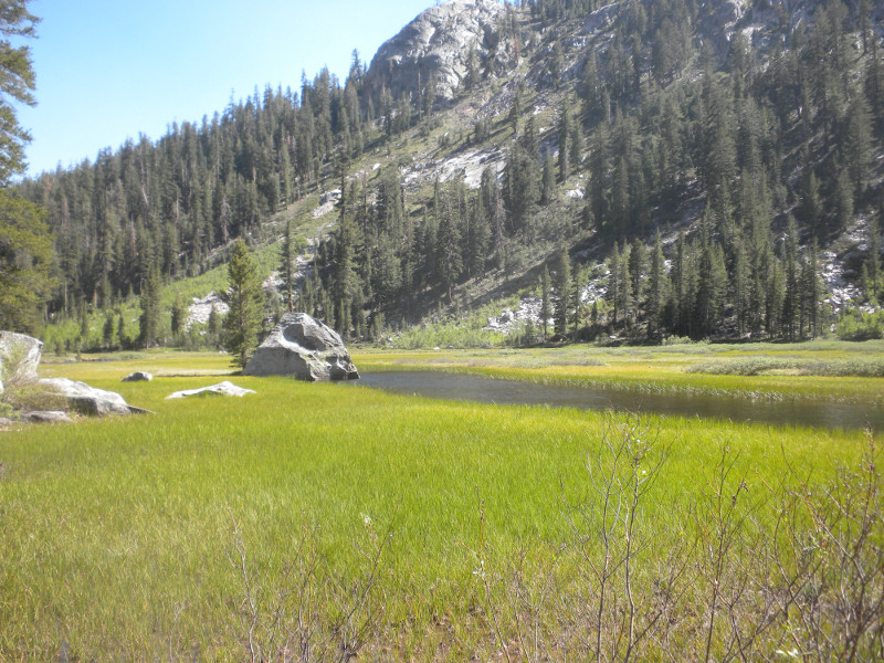
We made camp in a meadow that was the exact spot where I camped on my 2008 long distance trek on the PCT.

Here's my dinner. I make all my own backpacking food these days. I eat a grain-free diet and try to get a lot of protein. As far as I'm concerned, meat and fat is real food and everything else is just stop-gap until you can get real food.

This dinner is actually not that tasty. It's dried pulled pork and various veggies like dehydrated cooked carrots, Just Veggies, dried

The meadow where we camped.
Here's my Gossamer Gear One tent. Too bad they don't make tents anymore. This is a nice tent.
There's Tony's "tissue paper" tent. It's cuben fiber. We have separate tents because he will continue without me in a few days.
In the morning we left our meadow and headed up the trail.
Eventually we dropped to our first real creek, Rock Creek. There is a ranger station here.
We crossed easily on these logs.
We did a lot of ups and downs the first two days. I enjoyed when we hiked through these flat areas dotted with pines. It's a kind of forested desert feeling that I find pleasant.
I got ahead of Tony quite a ways so I had to take this selfie of this large tree on my own. That's why it's tilted.
More climbing.
More mountains. We're not quite yet into the High Sierra. It's still the Southern Sierra.
We can see the High Country coming up.
I saw a bird's nest in a pine tree by the trail.
We came to a nice meadow with a large mountain.
There are high peaks in the distance.
We come around a bend to our first view of Mt. Whitney. We don't have plans to climb Whitney but many thru-hikers do.
Whitney with Crabtree Meadow below.
Crabtree Meadow.
We stopped at Crabtree Meadow where the PCT crossed the creek to fill our water. Here is my Sawyer Squeeze Mini contraption. Basically I cut two Platypus tubes short and use Platypus bags instead of Sawyer Squeeze bags to do the filtering. I cut one side a little too short but it works just as well. Filtering water is a pain in the butt and I quit doing it after we got higher.
Leaving Crabtree Creek (assuming that's the name).
High mountains off to the west.
We hiked through a series of ups and downs with lots of meadows in between. It was quite exhausting. The heat and intense sunlight in the middle of the day made it quite exhausting.
We reached Wallace Creek which was a wet ford for me. The rocks didn't quite cut it.
We are starting to get higher and see more of the High Country.
Here's me looking dorky and squinty in the hot sun.
We're getting high now!
Tony with a great view.
I think Forester Pass is in this picture and that is why I took so many pictures of this view. It is hard to tell now.
We are climbing into Bighorn Plateau, which is more amazing when you are there than the pictures can show. Lots of marmots here.
Mountains off to the West on the other side of the Kings River.
Some foreboding-looking clouds are forming. Nothing came of them.
Finally we come to Tyndall Creek. I simply walked in the creek rather than try to keep my feet dry. Sort of a bad idea since our camp was right on the other side. Now I'd have to either walk around barefoot or have wet feet all evening. I chose to walk around barefoot.
Here's my tent set up at the campsite at Tyndall Creek.
Here's Tony's tissue paper tent. It's a 6-Moons Designs cuben fiber thing. It's actually pretty cool. You can fold up the outsides to reveal a bug net tent underneath. However, it's not very roomy inside. Tony is only 5'7" or 5'9" and can barely fit inside with his pack. I could probably fit better.
We set off in the morning toward Forester Pass. Walking through this meadow in the morning was just gorgeous. Realy alpiney and high feeling.
There's Forester Pass. We will be climbing toward that little snow patch in the cleft. Hard to believe there's a trail up there.
There are small snow patches to traverse. It's not at all like it was in 2008 for me. There was a lot more snow and it was difficult for me to walk on. I have since gotten a lot better at walking on snow.
Tony walking up the snow.
Because of his heavy pack, Tony tends to walk behind me most of this trip.
The alpine terraine as we approach Forester.
Tony with Forester in the background.
Frozen lake below Forester Pass.
The air was thin. I took a break to let some faster thru-hikers through and took the opportunity to take a picture of the frozen lake below.
We are nearing the final push. The trail has a lot of slippery ice but no snow.
If you look closely, you can see the switchbacks. There are even a couple of hikers there.
Here's a closer view of the switchbacks and hikers. One of them is Tony. He seemed pretty strong going up this last part.
Here's Tony at the summit of Forester Pass. This is looking toward the direction we must take down.
Proof!
We started down and immediately decided crampons would really help. They did help. A LOT! Crampons are a miracle.
Sometimes we postholed, which was no fun. The snow was softening quickly. The crampons helped make it so we didn't slip in the softening snow.
We are headed toward that valley with Bubbs creek splashing through.
After the snow we descended a difficult rocky section. Sometimes the snowback on the left covered the trail and we had to climb down rocks. It was trail most of the way, though.
There was one final difficult snow traverse and then the crampons could come off for good.
Blue ice lake.
Finally we are at tree line again.
A crossing of Bubbs Creek. Not a particularly dry crossing.
Now we enjoy a pleasant tromp along Bubbs Creek.
Corn Lilies!
Bubbs Creek with Forester Pass and all the snow we came down.
Nice mountains along the way.
More of these pretty pink flowers.
A slabby waterfall.
Tony is so silly. He's wearing three pairs of glasses. He decided his sunglasses weren't strong enough in the harsh high altitude light so he's got some clip-on sunglasses underneath his regular sunglasses and his reading glasses on top.
We enjoyed the hike down Bubbs Creek but then came a strenuous climb toward Kearsarge Pass. At least the views were nice along the way.
We reached the top where it flattened out a bit. There are two junctions toward Kearsarge Pass. We met a hiker waiting for friends at one of the junctions. Glen Pass is so close here but we did not want to climb it. There was no indication of water anywhere and we weren't sure there would be good campsites nearby. Tony was tired, so we decided to check out Charlotte Lake.
The descent to Charlotte Lake was disconcerting. We had climbed so hard to get up there and now it seemed we were climbing all the way down again. The lake was nice but would it be worth it?

Charlotte Lake. It was beautiful here but we weren't finding any campsites as we walked along the lake. We met a couple of thru-hikers who had been so enticed by the lake they had climbed straight down from the PCT to get to it and take a dip. They were sunbathing on a rock.

We decided to just fill up our water bottles and try to find a place to camp part way back up the hill.

I found this little nook for my tent. I was very warm here and the soft pine needle duff was so comfy to sleep on. I slept great.

As usual on this hike I miscalculated my food. I took a little out of each meal so I'd have enough meals for every day. Also because of the bear canister, I only could carry so much food so I had no treats or snacks. I had only breakfast, lunch and dinner and nothing more. These were my foods, all cold, no-cook, rehydrated for a few hours in a small plastic

Tony also found a spot not too far away.
In the morning we continued on toward Glen Pass. This is Charlotte Lake below. I can see why those thru-hikers felt they could just cross-country it down to the lake.
This interesting mountain deserved a picture.
Charlotte Lake again.
The climb to Glen Pass came upon us very quickly. It was so much easier than 2008. There was hardly any snow at all. It was basically just a high altitude hike up some switchbacks.
Glen Pass is up there somewhere.
Looking back at a little snow patch we had to traverse.
There's Tony traversing the snow.
Looking down from the summit.
View from the summit.
Here's the back side of Glen Pass. We sat up here a long time watching hikers struggle along these tracks. We ended up choosing the lower tracks for our own traverse.
It was a fairly hairy descent, but the crampons made it more managable. Until the rocks. Then we removed them for a spell to climb down all these rocks.
This is looking back up at the snow we came down.
You can see two small hikers and a lot of tracks going all over the place.
Two women thru-hikers in the group we found ourselves in, who were both ship captains, said that these clouds portend rain. They were not wrong.
You can see some of the tracks we had come down.
After a while we are among living things again.
Now we are at the Rae Lakes, some of the nicest lakes on the trail. Many backpackers specifically make Rae Lakes their destination.
We took a break here. Some thru-hikers went swimming. The water was very cold but there were cliffs you could jump off into the lake that were almost irresitible.
View from the cliffs.
We went down the 60 Lakes trail to the "kiddie pool" where we took some time to wash the dirt off our legs.
Then we continued on along the PCT as it went along the lakes.
The PCT makes you cross on this log between the two lakes. The two lakes are separated by an outlet "stream" that barely separates the two lakes at all.
Tony crossing the log.
Looking back up at GlenGlen Pass and one of the Rae Lakes.
We continued down the canyon past the second Rae Lake.
There is a ranger station here at the second Rae Lake.
Can you imagine having a job where this is the view from your workplace?
We hiked on and stopped for lunch at Arrowhead Lake, also a lovely lake.
Arrowhead Lake becomes a meadow with a meandering stream to cross.
It was a fairly difficult crossing. There were logs for part of the crossing.
The next lake was Dollar Lake. No camping allowed here.
Dollar Lake seemed rather inviting.
We are headed up there. Somewhere up there is Pinchot Pass. It's going to be quite a drop first before we can get up there.
Here's a rather wet ford.
Tony's usually pretty good at keeping his feet dry. This creek stumped him.
They did manage to put a bridge over a tiny little creek.
I guess they wanted to protect you from this dangerous swamp.
We are continuing our descent to Woods creek so that we can begin our climb to way up there.
Pinchot Pass is in that dip in the center.
It just looks so impossibly steep and so impossible to get up there. It looks so empty, too.
I think this might be heather.
Shooting stars. They seem more dainty in the Sierra.
Just a random picture of the trail. We are descending quite a ways and it's getting lusher and more moist. There are aspen here.
We get to Woods Creek and a thunder storm hits. There is even flattened hail. I quickly set up my tent so we could sit inside and decide whether to stay here or go on. There was an annoying older man camped here that Tony didn't like. There were also lots of thru-hikers here. The rain only lasted a few minutes so we packed up and continued on. This is Tony crossing the suspension bridge over Woods Creek.
We ended up camping a few miles up the canyon with a whole bunch of thru-hikers. We had a campfire and sat around telling stories from our hikes. It was a lot of fun. In the morning we continued climbing toward Pinchot Pass. The view was just gorgeous. This is the view from where I took a dump. Can you buy a better view for your crapper than this?
Still the view from my morning constitutional.
The climb to Pinchot Pass was bleak but not difficult at all. In 2008 the snow made me play hide and seek with the trail all day.
I sat at the summit of Pinchot Pass for an hour. Forty minutes of that was waiting for Tony. He started to get really tired or sick or something and was more and more further behind me each day.
View from Pinchot Pass.
On the way down I snapped a picture of a marmot. We saw lots of marmots and even a few picas.
There's always a frozen lake below these passes.
Mather Pass is next. It's off in the distance. If you are a fairly strong hiker, you could easily do Forester and Glen Pass on the same day, or Glen and Pinchot or Pincho and Mather. Some strong hikers we were with on top of Glen made it their mission to do Mather Pass the same day. I have no doubt they did it. Even we could have done it if we'd wanted to.
Down near the South Fork of the Kings River we saw a bear!
He was very close. At one point he stopped and looked right at us. I had a feeling he was going to do one of those bluff charges so I said let's get out of here!
I guess when they look all scrawny and scraggly like this one it means they eat too much human food. There was a rather large campsite nearby.
The ford of the South Fork of the Kings River was a wet one.
We walked along this creek through God's Golf Course, as I named it.
It was just so beautiful here.
We ended up camping here in God's Golf Course. We woke up to tremendous condensation. Once I emerged from my tent the condensation turned to ice. There were a lot of thru-hikers camped nearby too.
You can't purchase better lodging than this.
My attempt at capturing the golden hour in the evening. This was the view from my tent. I suppose if you count what it costs to board our parrots each day we're away, this view wasn't all that terribly inexpensive.
In the morning we began the gentle approach to Mather Pass. Mather Pass was the scary pass in 2008 that was the last straw to me quitting the trail and driving home.
I was stunned to see that Mather Pass was completely snow-free. This was all snow in 2008 and was a scary vertical climb up the snow.
This is the only snow left on Mather Pass on the front side. It was an easy bunch of switchbacks to the top.
The view from Mather Pass looking northbound.
Still looking out from Mather Pass.

The descent was pretty tricky. We were up here around 8:30AM and the snow was iced over. Fortunately we had our crampons. Even with the crampons it was tricky. The snow was vertical and there were many places where we had to climb down rocks, which isn't easy with crampons on. But we were with a huge group of thru-hikers and it was a ton of fun finding our way down.

This is Short Skirt and Loooonnnnggg Jacket taking a picture of Mather Pass. They were a really nice couple from Canada

Just more beautiful mountains. Ho hum.
We are continuing down down down.
Back to the world of living things.
An interesting log ford.
Now we approach the Palisades Lakes.
There are two Palisades Lakes. The first one is below us, out of reach.
The second one we walk along the shore. It's very inviting. We decide to take a break and dry out our wet tents and things. I bathed in the water (no soap of course). It was very very cold. Brrr.
The Palisades Lakes end in a cliff. It's amazing that we will descend the cliff. It's very calm and serene at the edge of the precipice. No indication that you're at the end of the world.
There are many many trout in the outlet stream. If I were going fishing, I would come here.
The outlet stream of the Palisades Lakes. Some of those specks are trout. The edge of those trees there is the ends of the earth. It's a cliff from there.
We have begun the descent.
The serene outlet stream becomes a roiling creek as we descend.
We must drop into that valley and head to the end of it, then turn right and go up the next canyon, Le Conte Canyon, toward Muir Pass.
Palisades Creek is really roaring now. In 2008 I was so terrified the trail was going to make me have to cross it. Terror, lonliness and hunger were my main memories of this section. I was glad to be replacing those memories with better ones this time around.
After a bone-crunching descent through a million small switchbacks we reached aspen trees.
Then we reached the pine forest. It was very hot with intense sunshine here.
Amazingly, we are still not at the bottom and have quite a ways to descend.
The aspen trees were lovely.
There were ferns among the woods, too. It was fairly lush down here.
I finally made it to the junction with Le Conte Canyon. I was exhausted and sat down in the shade against a tree to rest. Tony arrived in about 10 minutes and seemed very annoyed with me but was fairly evasive about sharing his feelings. We agreed to part ways here rather than camp together near the Bishop Pass trailhead. I continued on without him up Le Conte Canyon. This is the creek in Le Conte Canyon.
It's quite a roaring creek and I was quite hot and thirsty. Fortunately I found a small creek soon enough. My water strategy, having days ago gotten tired of the whole filtration thing and carrying water around, was to simply fill a 16oz bottle every now and then and take a drink. Living on the edge as far as water goes. Sometimes I hiked without carrying any water at all, trusting that a creek would come along soon enough. I really enjoyed doing it that way. And no, I don't worry about Giardia.
Here's Grouse Meadow. It's very pleasant hiking up Le Conte Canyon.
Meandering stream in Grouse Meadow. At one point I heard a strange-sounding bird. Perhaps it was a grouse.
I felt pretty strong so I headed up the Bishop Pass trail. I was also pretty hungry. I hiked with a growling stomach with the goal that the first campsite I came to was mine. I camped here in the deep woods. There were mosquitoes here. I was at less than 10,000 feet. It was a very cold night for some reason, but I think it was a lot warmer down here than had I made it all the way to Dusy Basin to camp.

I woke up at the first sound of birds (probably 5:00AM) and made the final climb to Dusy Basin. I decided I would have breakfast up here by this nice lake. Man I was hungry! It was a lot further and a lot more strenuous to Dusy Basin than I expected. It was also extremely cold up here. I had to put on all my down and fleece just to have breakfast.

I think Dusy Basin is one of the prettiest places I've ever been, and I've only ever been here alone. There is this nice lake surrounded by a

The cliffs are just gorgeous. In 2008 I was so scared, lonely and hungry that I bailed off the PCT over this pass. I stared at those cliffs with resolve thinking that if the trail was going to make me climb over them to get out, I would do it.

As I continued along the trail I met up with a thru-hiker who had used Bishop Pass for a resupply. He complained that it was so cold. He was hiking in flip-flops and bare feet! Later on going up the pass, which is all sandy toward the very top, I

Turns out the pass is a much lower location than those crags and spires. It's up ahead in the foreground with some craggy spires behind it.
Another look toward Dusy Basin as I climb away from it.
I took a selfie at the summit of Bishop Pass. I suck at selfies. You can't see the sign! It was freezing up here, slightly windy and the water on the trail was all iced over.
There was some snow on the way down but it was manageable.
There are many lakes in the valley below.
There were a few snow banks on the trail making me have to climb over the rocks instead. Not nearly as bad as it was in 2008. I was really scared here in 2008.
Here's a section where I had to climb over those rocks. All those rocks are loose, even the big ones. In this picture I'm looking up. It's hard to really see what it was like.

The rest of the way down the valley was uneventful. I didn't take anymore pictures.

Once I reached the parking lot I tried to wash a little of the stink and sweat off. I asked the first person I saw if he was going to Bishop and if he had room for me. He said yes and took me to Bishop. Once there, I went to the nearest outfitter and asked about the bus to Lone Pine. It was leaving in 20 minutes so I ran as fast as I could to the bus stop and just made it in time. Forty-five minutes or