Little Pine Mountain and 19 Oaks
The hike to Little Pine is 10.5 miles round trip, very strenuous and steep with sun and cliff exposure. The summit is at 4500 feet elevation. The views of the Santa Ynez Valley are spectacular at the top and in spring there are many wildflowers.
For a shorter hike, you can stop at 19 Oaks at the 2 mile mark, a short overnight destination for backpacking. There is no risk of cliff exposure to 19 Oaks.
For a longer backpack trip, the trail continues into the Wilderness. You can find more information at Hike Los Padres. Look for Santa Cruz Trail.
Be advised that on hot days many people suffer dehydration and worse, so take preparations for hot desert conditions.
You will need an Pass to park.
The hike begins in the Upper Oso campground off Paradise Rd., first following an OHV road, then joining the Santa Cruz Trail.
Start in the overflow parking area at the far end of Upper Oso Campground.
The trail, which is actually called the Santa Cruz trail, begins on the dirt road. Pass through the metal gate to begin the dirt road. The dirt road parallels the creek, which offers inviting pools if you want to scramble down the hill.
At the 3/4 mile mark is the junction with the Santa Cruz Trail, marked by a sign announcing the trail and the distances. Some of the distances appear to be inaccurate.
At about 1.5 miles there are some unusual cinnabar rocks. Cinnabar is a mercury ore.
At about 1.75 miles you reach the junction with a small trail leading to 19 oaks. Turn right on this small trail to reach the camp, which is primitive. The trail to the camp is short.
To return to your car from 19 Oaks, turn around and head back the same way you came a total of 4 miles round trip.
To continue to Little Pine Mountain, cross the small creek crossing and begin heading up the hill.
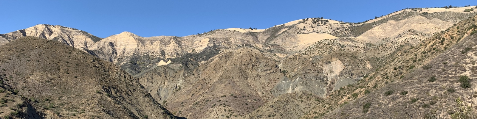
The trail winds up steeply through meadows and steep slopes covered with sparse vegetation. There are many yucca plants, distinctive with their spear-like leaves. They hurt when you are punctured by the tips of the leaves, so be careful. The soil is a gray-green color, and in some places doesn't support much life at all. This gray-green soil is serpentine.
As you ascend there is a persistent slide area that can be difficult to cross.
At the 5 and 1/4 mile mark you reach Alexander saddle where there is a junction. To reach the summit, turn right at the junction and head very steeply up the hill.
At the wood and wire fence, turn right and continue steeply up the hill.
The summit is not a distinct point, but a nice place to end is beneath the small grove of oak trees, or in the field beside them. The views are beautiful, but the summit is often windy and cold. On rainy days it can even snow up here.
To return to the car, head back the way you came, a total of 10.5 miles round trip.