Lost Valley Trail
Lost Valley Trail begins along the Manzana Trail from Nira Campground.
The trail used to be a road long ago, but the vegetation has closed in significantly, making it a trail again.
The trail crisscrosses a small creek that almost always has water in it, no matter how late in the season it gets. At some places there is the distinctive smell of sulfur that gives the creek its name, Sulfur Creek.
As you travel up Lost Valley trail you enjoy riparian vegetation, sparser hillside scrub, and occasional pine trees which rustle gently in the wind. There's no real destination for a day hike, although the trail ends at Hurricane Deck Trail.
You will need to pay for parking at NIRA. Many people park outside of the campground near the water crossing on the road.
The hike begins at the end of Nira Campground at the large informational sign marking the San Rafael Wilderness area.
1 tenth mile, cross Manzana Creek.
At about 1 mile you will reach Lost Valley Camp. Nearby there should be a sign post marking Lost Valley Trail, but it is easy to miss. If you pass the camp you will have gone too far. At the beginning of the Lost Valley Trail there is a large rusty metal sign marking distances to Hurricane Deck and White Ledge. Some of these distances appear to be inaccurate.
The trail used to be a road, so it is gentle uphill. But since that time, the road has closed in with vegetation and rockslides to the size of a trail again.
At 2.5 miles or so you will come to a small metal sign with an arrow pointing to the right marked “trail.”
At about the 4 mile mark you reach a small camp beneath a very large oak tree. Oak Tree Camp or sometimes called Twin Oaks Camp. The trail will appear to go in several directions. The trail you want crosses the small gully.
The trail begins a large, swooping switchback up the side of the hill.
At about 4.5 miles there is a barely dripping spring. This is your last chance for water if you are heading to Hurricane Deck. There may only be a small pool formed in the trail.
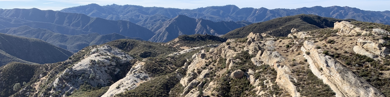
You can continue up Lost Valley for several more miles. The terrain begins to change and becomes more and more rugged and remote. There are many unusual rock formations and impressive cliffs to look at.
At 7 miles there is a wood and wire fence, partially collapsed. There are some flat areas to camp. This is called Cowboy Camp.
At 8 miles there is a severe landslide, making the trail rough-going as you hike through the softened, slumping sand and rock.
At 8.25 miles is the junction with Hurricane Deck Trail.
To return to your car, head back the way you came.