White Ledge Loop
Nira -> Manzana Trail -> White Ledge -> Hurricane Deck East -> Lost Valley Trail -> Nira (25 miles)
The name White Ledge Loop is from D. Gagnon book Exploring the Santa Barbara Backcountry, 1981
If you love real backcountry hiking and want to see some very beautiful country, this is a great hike. As a day hike it is very long--25 miles in overgrown, mountainous terrain for a total of at least 12+ hours of hiking for someone in great condition. Best as a backpack trip.
Avoid in the hottest part of summer. Bring plenty of water, more than you think you'll need. To make a dayhike start early at 5 or 5.30 am. Check forest service regulations for campfires and stoves. They are often prohibited.
The hike begins at the end of Nira Campground and follows the Manzana Trail. You will pass Lost Valley Camp, Ray's Camp and Manzana Camp.
Once you reach the Manzana Narrows camp, I like to think that now the hike is just beginning.
About a few hundred yards past the Narrows camp there is a junction, marked with a sign, to the trail going up to Big Cone Spruce.
The Big Cone Spruce trail crosses the creek to the right. Stay straight.
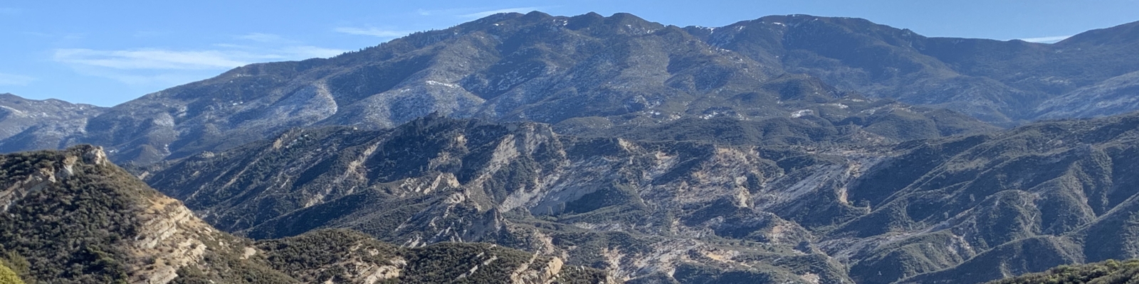
Now the switchbacks begin. At the top of them you will be at the base of some impressive cliffs.
As you walk by the cliffs the country-side gets more piny and pretty. You will be taking a gentle climb up and parallel to some very beautiful white cliffs. This is why White Ledge has its name.
At your highest point you will reach a place with a very striking, sweeping view toward the east. The trail will be heading down from here. It is a natural place to stop and take a rest.
Now you will descend. At the bottom, the trail crosses places that in wetter months have smooth, round puddles of water. You will reach Happy Hunting Ground campsite.
From Happy Hunting Ground the trail continues along the creek. For about a mile you are in the creek, hopping the rocks. A couple places are tricky.
Around a mile from Happy Hunting Ground you reach White Ledge Camp. It's a very refreshing spot, usually with plenty of water (in deep puddles during fall). This is your last water for a long long time. Hurricane Deck is hot and dry.
Here at White Ledge you are at a junction. The trail you have been on continues down the creek toward its junction with the South Fork of the Sisquoc River. It makes a grand 45 mile loop around the back of Hurricane Deck in the Sisquoc River Valley. It meets back up with the Manzana River at the Manzana Schoolhouse where Manzana River and Sisquoc River join. There the trail joins back with Nira. I highly recommend Bryan Conant's San Rafael Wilderness map, which is color-coded with the conditions of the trails. You can buy it in many local outfitter stores, or online.
Anyway, this hike is destined for Hurricane Deck, so instead of continuing downstream here at White Ledge you cross the creek at the camp site and look for a trail on the other side. There is an iron sign that may have fallen down that lets you know you've found Hurricane Deck trail.
This section of Hurricane Deck is very beautiful, with sweeping rock formations and lots of bear and mountain lion prints. It is often overgrown and can be difficult to follow in some locations.
The junction with Lost Valley Trail is marked with a fallen sign.
The rest of the hike follows the Lost Valley trail to Nira campground.
If you do this entire hike, it's somewhere in the neighborhood of 23-25 miles.